To access the other concept sheets in the Cities Subject to Natural Hazards module, check out the See Also section.
Geological hazards are natural hazards related to the movement of tectonic plates and the Earth’s crust.
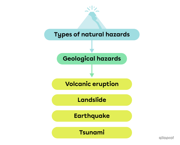
A volcanic eruption is the expulsion of lava, gas and/or ashes by a volcano.
A volcanic eruption can cause lava flows as well as clouds of ash and toxic gases. All of these elements represent a hazard for the populations living near a volcano. People who live several kilometres from a volcano can also be at risk, since winds can carry clouds of ash and toxic gases over great distances.
Volcanic eruptions take different forms.
These volcanic eruptions cause many lava flows, which can reach an average speed of 25 km/h and attain a temperature of 1200°C. They are referred to as “red volcanoes”[1].
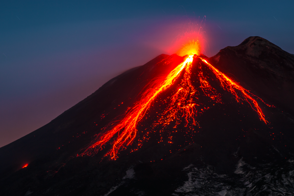
Source: Fernando Privitera, Shutterstock.com
Explosive volcanic eruptions are generally much more dangerous since they are often unpredictable. Lava, ash and rocks are projected into the air and can land hundreds of kilometres away. These are referred to as “grey volcanoes” because of the huge grey cloud formed by the ash and toxic gases.
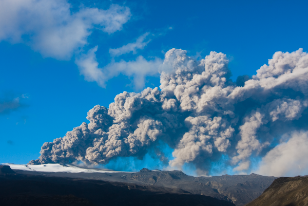
Source: Johann Helgason, Shutterstock.com
The duration of a volcanic eruption can vary from a few minutes to a few hours, a few days, a few weeks, a few months and, in some cases, a few years. The average duration of a volcanic eruption is one-and-a-half months. The Kílauea volcano, in Hawaii, is the most active volcano in the world, with a volcanic eruption that has been ongoing for 39 years. Even more impressive, Stromboli, in Italy, has been spitting lava approximately every 15 minutes for over 2400 years.[2]
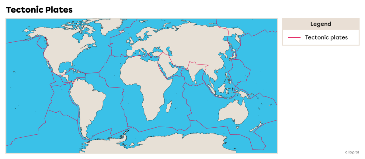
There are more than 1500 active volcanoes on Earth and most of them are located along the Ring of Fire. There are also approximately 1.5 million volcanoes hidden under the oceans[2].
The Pacific Ring of Fire is a path along the Pacific Ocean with a lot of earthquake and volcanic activity because there are more than a dozen tectonic plate boundaries there. The Ring of Fire is:
-
40,000 km long
-
the site of 75% of the world’s volcanoes
-
the site of 90% of the world’s earthquakes[7]
An earthquake is more or less violent shaking of the Earth’s crust caused by the movement of tectonic plates.
To find out more about the formation of earthquakes, take a look at the concept sheet on earthquakes.
Each year, there are millions of small earthquakes. Most are too small to feel[3]. In Canada, there are 4000 earthquakes a year, but most of them are not felt[4].
The scale most commonly used to measure the magnitude of an earthquake is called the Richter scale.
| Magnitude of an earthquake | Impact |
|---|---|
| Less than 3.5 | An earthquake of this magnitude is detected by seismographs, but is not usually felt by people. |
| 3.5 - 5.4 | At this magnitude, an earthquake is often felt, but rarely causes damage. |
| Less than 6.0 | An earthquake of this strength can cause slight damage to buildings and solid infrastructure. However, it can cause major damage to people close to the epicentre, where the movement originates. |
| 6.1 - 6.9 | Between these magnitudes, an earthquake can cause damage over an area up to 100 km around the epicentre. |
| 7.0 - 7.9 | An earthquake with a magnitude of 7.0 or more is considered major and can cause serious damage to infrastructure over hundreds of kilometres. |
| 8.0 - 8.9 | An earthquake of these magnitudes causes very serious damage and loss of life over an area of hundreds of kilometres. |
| 9.0 and above | An earthquake with a magnitude of 9.0 or more is rare. It causes serious material damage and can lead to great loss of life over a 1000-km area. |
Source: Government of Canada, 2021[5]. |
|
Magnitude is the strength of an earthquake. It is measured using the Richter scale, which ranges from 1 (the weakest) to 9 (the strongest).
In 1960, Chile was hit by the most powerful earthquake ever measured, with a magnitude of 9.5. This monster earthquake, which was followed by a tsunami, killed approximately 5700 people. Four years later, Alaska was also hit by a particularly powerful earthquake, measuring 9.2 on the Richter scale, also followed by a tsunami. About 100 people were killed[6].
Consequently, the most powerful earthquakes are not necessarily the most deadly. This is related, among other things, to the population density of the area affected by the earthquake.
Population density refers to the average number of individuals living in a given area. It measures the number of inhabitants per square kilometre (inhabitants/km2).
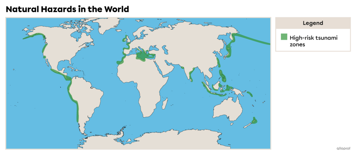
A tsunami is a series of huge waves triggered in the ocean that can cause major damage to inhabited areas along the coast.
| Causes | Earthquake or underwater volcano |
|---|---|
| Wave speed | Up to 800 km/h |
| Wave height | When they reach the coast, they can be up to 30 metres high |
| Consequences | Serious material damage and loss of life because the waves can reach many kilometres inland |
| Location | 80% of tsunamis occur along the Ring of Fire |
Source: National Geographic, (s.d.)[8]. |
|
To find out more about the formation of tsunamis, take a look at the Earthquakes concept sheet.
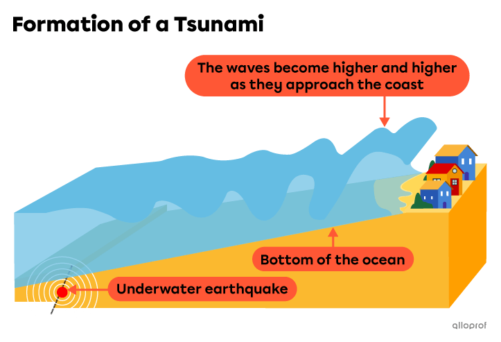
On December 26, 2004, at 7:59 a.m. local time, a 9.1 magnitude earthquake hit in the Indian Ocean. This powerful earthquake led to the formation of an enormous tsunami that affected 12 countries in Southeast Asia. In a few hours, the deadly waves killed more than 230 000 people and thousands of others disappeared, mostly in Indonesia and Sri Lanka. The tsunami also left 1.5 million people homeless[9].
To find out more about these events, check out the article The Deadliest Tsunami in Recorded History
A landslide occurs when the soil along a slope becomes unstable. The soil collapses and can lead to the downward movement of mud, earth, rocks and debris.
Landslides are the most widespread geological hazard and can occur anywhere in the world. Between 1998 and 2017, 4.8 million people around the world were affected by landslides, causing 18 000 deaths[10]. Landslides that occur in cities can cause serious damage to buildings, roads, bridges and other infrastructure.
Many factors can cause landslides:
-
erosion
-
heavy rainfall
-
rapid snow melt
-
angle of the slope
-
soil properties (clay, sand)
-
drainage work, tree cutting or other types of work
On May 4, 1971, a landslide swept away half of the village of Saint-Jean-Vianney in the Saguenay region. More than 40 houses and many cars disappeared into a huge hole. The landslide swept away bridges, roads and many other buildings. Thirty-one people were killed and hundreds of others lost their homes[11]. The disaster caused an estimated $2 million in economic losses. The village of Saint-Jean-Vianney was permanently shut down a few weeks later and 1700 people had to relocate[12].
The Saint-Jean-Vianney disaster prompted the Quebec government to map out the areas in the province that are at greater risk of landslides.
To access the rest of the unit, please consult the following pages.
- Futura Sciences. (2017, 8 avril). Éruption effusive: qu’est-ce que c’est?. https://www.futura-sciences.com/planete/definitions/structure-terre-eruption-effusive-13947/
- Fannière, Mathieu. (2019, 21 janvier). Pour tout savoir sur les volcans. Les débrouillards. https://www.lesdebrouillards.com/quoi-de-neuf/pour-tout-savoir-sur-les-volcans/
- Gouvernement du Canada. (2021, 6 avril). Fréquence globale des tremblements de terre. https://www.seismescanada.rncan.gc.ca/info-gen/magfreq-fr.php
- Berry, Michael J.. (2015, 26 juin). Tremblement de terre. L’Encyclopédie canadienne. https://www.thecanadianencyclopedia.ca/fr/article/tremblement-de-terre
- Gouvernement du Canada. (2021, 6 avril). Échelles séisme de magnitude. https://www.seismescanada.rncan.gc.ca/info-gen/scales-echelles/magnitude-fr.php
- Lutaud, Bénédicte. (2011, 11 mars) Les séismes les plus puissants depuis un siècle. Le Figaro. https://www.lefigaro.fr/international/2011/03/11/01003-20110311ARTFIG00522-les-seismes-les-plus-puissants-depuis-un-siecle.php
- National geographic. (s.d.). The Ring of Fire. https://www.nationalgeographic.com/science/article/ring-of-fire
- National geographic. (s.d.). Tsunamis. https://www.nationalgeographic.com/environment/article/tsunamis
- Rais, Cécile. (2019, 27 décembre). Le tsunami du 26 décembre 2004 minute par minute. RTS. https://www.rts.ch/info/monde/6390807-le-tsunami-du-26-decembre-2004-minute-par-minute.html#timeline-anchor-1577393872957
- World Health Organization. (s.d.). Landslides. https://www.who.int/health-topics/landslides#tab=tab_1
- Radio-Canada. (2016, 4 mai). Il y a 45 ans, Saint-Jean-Vianney sombrait dans un glissement de terrain. https://ici.radio-canada.ca/nouvelle/779449/saint-jean-vianney-glissement-terrain-45-ans