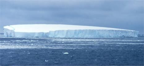
The cryosphere comprises the frozen portion of water on the Earth’s surface.
The term cryosphere comes from the Greek words kruos, meaning cold, and sphaira, meaning a spherical object. The cryosphere is the portion of the Earth's surface where water is in a solid state. It includes ice floes and pack ice, glaciers, large expanses of snow, frozen lakes and rivers, and ice found in permafrost. The cryosphere contains nearly 80% of the world's freshwater reserves.
A glacier is a mass of ice formed by the accumulation and settlement of layers of snow on land.
Glaciers, located on land, contain around 79% of the planet's freshwater reserves. They are found in areas where temperatures are low enough to maintain water in the form of ice and snow, either at high altitudes or at high latitudes.
The superficial part of the glacier is made up of snow from precipitation. The lower part is formed by the accumulation and compaction of snow over the centuries. This ice allows the glaciers to move very slowly, under the pressure of their own weight and the slope, and thus to flow into the valleys and the seas.
A glacier is different from an ice floe or pack ice. Glaciers are formed on land (on continents), while ice floes and pack ice float on water (in oceans).
There are two main types of glacier: ice caps and glaciers dependent on relief.
When a glacier covers a very large area and there are no landforms limiting its development, it is an ice cap. These are of two types: ice sheets and local ice caps.
-
An ice sheet (or polar ice cap) covers almost an entire continent. Two areas of the globe are covered with this type of glacier: Greenland and Antarctica. Their average thickness is 2 km.
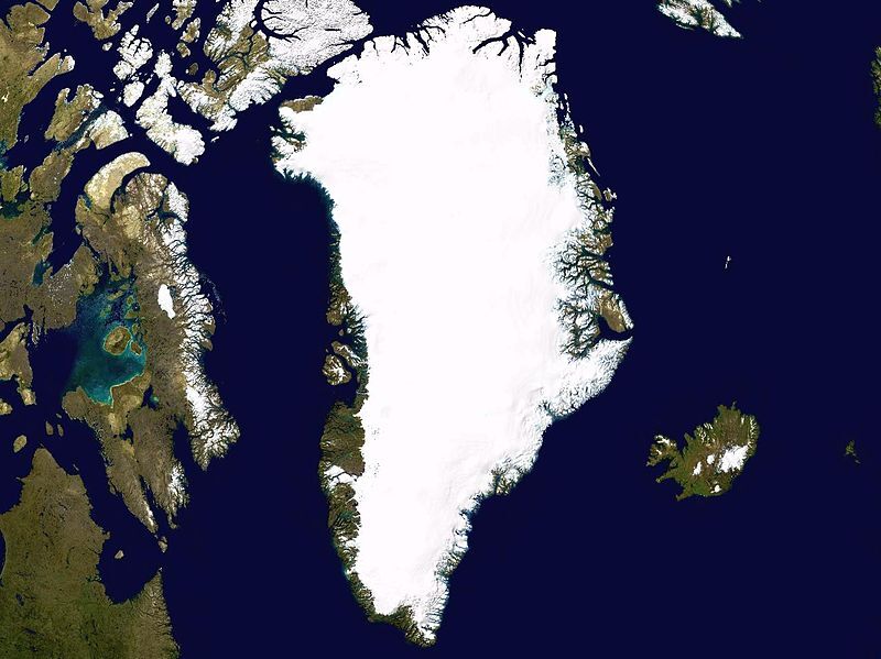
Greenland Ice Sheet
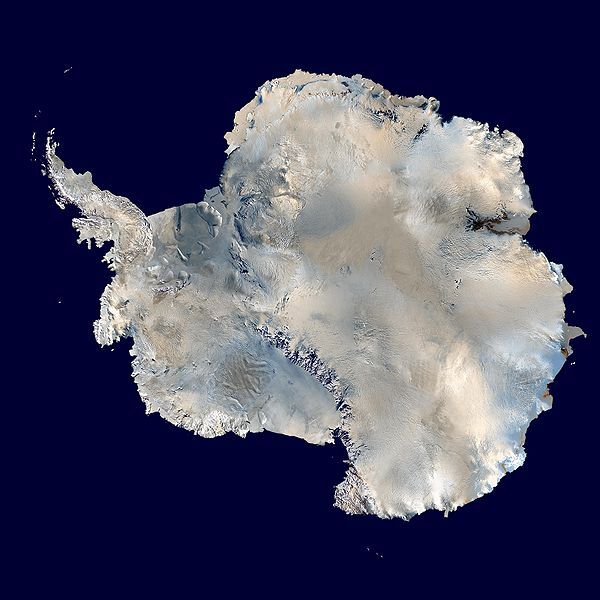
Antarctic Ice Sheet
-
A local ice cap, of smaller size, is located at the top of the mountain ranges. Sometimes referred to as a summit glacier, local ice caps, under the effect of gravity and mountain ridges, extend towards the valleys where they form relief-dependent glaciers.

The Furtwängler Glacier at the top of Kilimanjaro

Vatnajökull in Iceland
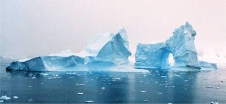
When an ice sheet reaches the sea, it is likely to break into huge chunks due to the impact of tides and waves. These pieces of ice, floating adrift on the oceans, are called icebergs. The emerged part (outside the water) of an iceberg is only about 10% of the ice block. Icebergs float on the water for several months or even years before melting and disappearing.
Unlike ice sheets, the development of a relief-dependent glacier varies according to the relief elements in which it is found. Generally, its flow follows only one direction corresponding to the slope of the watershed. There are three types of relief-dependent glaciers.
-
Cirque glaciers (or hanging glaciers) forming in hollows near the peaks of high mountains.
-
Valley glaciers, as their name suggests, are embedded in valleys surrounded by high cliffs. They are generally long and narrow.
-
Piedmont glaciers are found in plains at the foot of the mountains. They are located where valley glaciers spread out.

Cirque glacier

Valley glacier
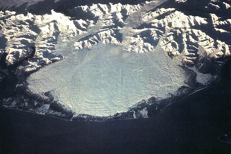
Piedmont glacier
Ice floe and pack ice are vast sheets of ice floating on the oceans near the North and South Poles.
Unlike glaciers, ice floes and pack ice float on the surface of the oceans in the polar regions. It is formed by salt water (sea water from the polar regions) freezing into more or less compact patches of sea ice. The ice formed must be thick enough not to be broken under the impact of waves. When it is thick enough, it creates ice floes and pack ice.
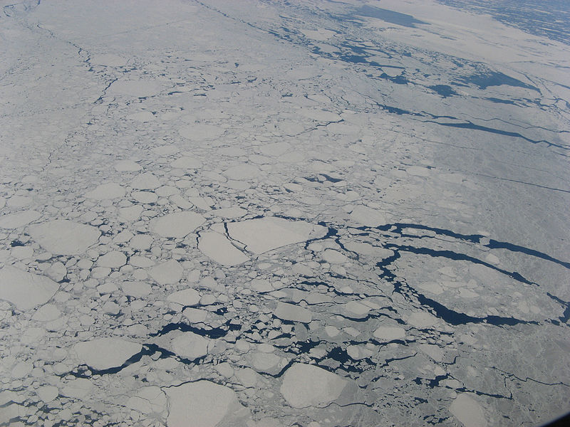
Ice floe in the Labrador Sea
There are two types of ice floes.
-
In fact, one part of the cold oceans is permanently covered with a thick and compact ice floe which remains in place throughout the years. This is the permanent ice floe, or pack ice. In the Arctic, its maximum thickness is estimated at 4 or 5 m.
-
During the polar winter, the ice floe extends along the edge of the permanent ice floe and the coasts. Coastal ice floes, also called seasonal ice floes, build up there. These disappear each spring during ice breakup and form again with the arrival of a new winter.
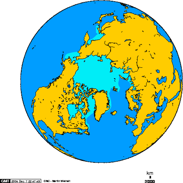
Arctic ice floe in February
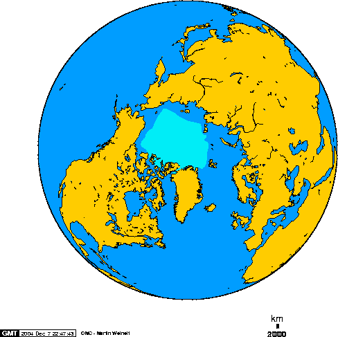
Arctic ice floe in September
The freezing point of salt water is slightly lower than that of fresh water (-1.9 ºC compared to 0 ºC). When ice floes form, the dissolved salts are released into the sea water. Thus, the salinity of these regions increases, which in turn increases the density. This water therefore sinks to the bottom of the oceans and is an important vector for thermohaline circulation.
The Arctic, which lies to the north, is a region of frozen salt water surrounded by land. The Arctic is therefore a region where there are a lot of ice floes. Canada, Alaska (United States), and Greenland (Denmark) surround the Arctic. The limits of the Arctic are also determined by water temperature. In fact, the water should be no warmer than 10 ºC during the warmest periods of the year.
With climate change, some environmental groups estimate that the vast Arctic region has lost 40% of its ice over the past 40 years. The situation is worrying, because it disrupts the ecosystem of this polar region, including the animal populations living on immobile ice floes during specific months of the year. The situation of polar bears comes immediately to mind.
This rapid melting of the world's glaciers and ice floes will also cause another problem that is likely to affect hundreds of millions of humans. Indeed, the melting of these glaciers and ice floes will lead to the rise of the world’s oceans and seas. As a result, hundreds of coastal towns will be flooded, creating a significant migration of people from these towns. If all continental glaciers were to melt, almost 30 x 106 km3 of ice would become liquid, causing sea level to rise by about 0.08 km (80 m).
This ice melting can also seriously disrupt the thermohaline circulation. This would have a major impact on the climate regulation of many regions, modifying the lives of a large number of species living in these regions.
Not only will this have serious consequences on Arctic wildlife, but a new problem would emerge with global warming. In fact, in just a few years, this large marine territory, which was formerly protected by its climate, will become accessible to other countries by navigation. These new waterways in northern Canada could have serious consequences for the protection of water quality (risk of spills, etc.) and for the protection of Arctic wildlife.
