To access the other sheets in the Tools in geography unit, consult the See Also section
Physical geography is the study of the various components of the Earth's surface. In the high school geography program, three of these components are particularly important: relief, hydrography and climate.
Relief is an important element to take into account when studying a territory. It has a direct impact on how people use the land. Indeed, plains are often places where the land is fertile, which is conducive to agriculture and human settlement. Conversely, mountains are not suitable places to build houses or roads because of the rugged terrain.
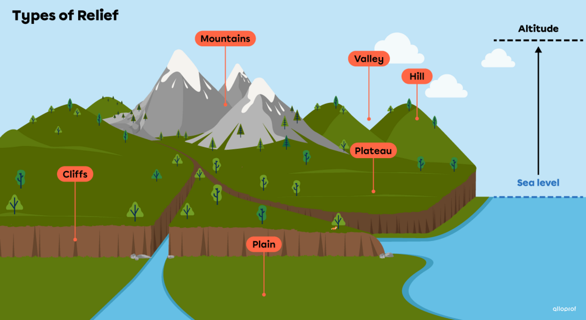
Relief refers to the set of terrain variations (humps, hollows, plains) present on the Earth's surface.
There are different types of relief, such as mountains, valleys, hills, plateaus and plains.
-
A mountain is a relief that rises very high.
-
A valley is a hollow located between two elevated areas, such as mountains.
-
A hill is a small elevation of land with a rounded top.
-
A plateau is a relatively flat region that can be found at different altitudes. Plateaus are carved by valleys through which rivers flow
-
A cliff is formed by a steeply sloping rocky escarpment.
-
A plain is a flat area of land.

To learn more about the formation of these different types of relief, you can consult the concept sheet on relief.
Altitude is the elevation (height) of a place in relation to sea level.
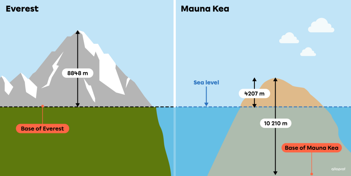
In general, altitude is measured from sea level. For example, the world's highest mountain, Everest, measures 8848 meters above sea level[1].
The Mauna Kea volcano in Hawaii has an altitude of 4207 metres above sea level. Despite this, some people consider this volcano to be the highest mountain in the world. In fact, the Mauna Kea, from its base, is 10 210 metres high[1]. However, most of this mountain lies submerged beneath the ocean. This is why Everest retains the title of the world's highest peak above sea level.

1. Mayer, N. (2019, May 22). L’Everest est-il vraiment le plus haut sommet du monde? Futura Planète. https://www.futura-sciences.com/planete/questions-reponses/montagne-everest-il-vraiment-plus-haut-sommet-monde-11482/