A weather front is a surface that separates two masses that have different physical properties (temperature, pressure, and humidity).
In fact, air masses do not mix. When two air masses come together, the one with the cooler air (denser, heavier) slips under the other air mass with the warmer (lighter) air, thus forcing warmer air to rise.
The greater the temperature differences between the air masses, the greater the activity of the fronts. Clouds of all types and precipitation are associated with the fronts.
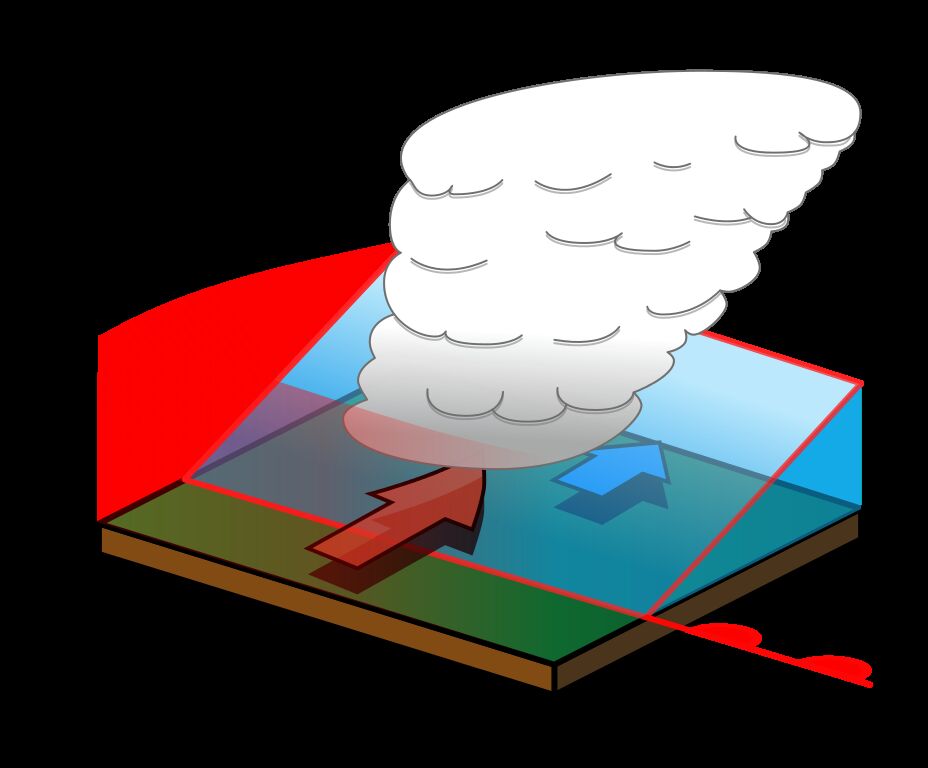
A warm front is produced when a warm air mass advances over a cooler air mass.
As the warm air rises, it cools and the water vapour in it condenses. The slope of the frontal zone of a warm front is gentle. Therefore, the warm air rises steadily.
-
Some precipitation will occur: There will be rain in summer, while a succession of snow, freezing rain and sleet could fall in winter. Ahead of a warm front, visibility will be significantly reduced.
-
The temperature will increase when a warm front passes.
-
Atmospheric pressure drops continuously as a warm front approaches.
Since the slope of the frontal zone of a warm front is weak, the warm front will therefore cover a larger region than the cold front. A warm front does not travel very fast, which is why precipitation will occur over a longer period of time.
It is a red line with semicircles that represents a warm front on weather maps. The semicircles point in the direction of a front’s movement.
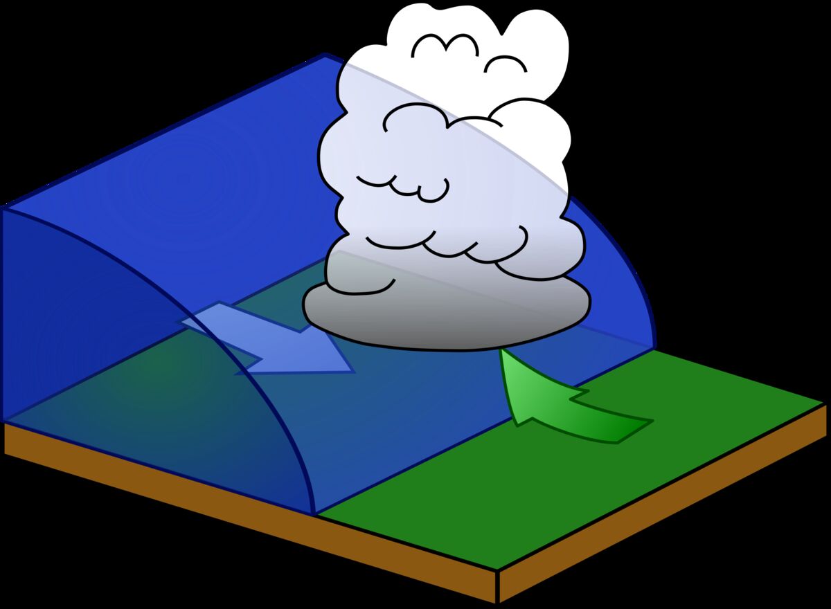
A cold front occurs when a cold air mass moves over a warm air mass.
Warm air then rises rapidly, it cools and the water vapor it contains condenses. The frontal zone of a cold front has a steep slope. The warm air (represented by the green arrow) is therefore lifted quickly and violently.
-
The air in a cold front is very unstable; thunderstorms and showers take place. Visibility is reduced when the precipitation passes, but it improves very quickly once the front has passed.
-
The temperature will decrease when a cold front passes.
-
There will be a sudden rise in air pressure as a cold front approaches.
-
The winds blow abruptly.
Since the slope of the frontal zone of a cold front is steep, the cold front covers a smaller region than the warm front. A cold front travels faster than a warm front. This is why precipitation of a shorter duration occurs.
Cold fronts are illustrated with a blue line and triangles on weather maps. The triangles point in the direction of the front’s movement.
A stationary front is represented by the limit between two fronts, one cold, the other warm, which remains in the same place without moving forward.
A stationary front has the same characteristics as a warm front but it is more "calm."
The symbol for a stationary front on weather maps is as shown below.
An occluded front develops when a cold front accelerates so that it overtakes the warm front. When the cold front reaches the warm front, the warm air becomes increasingly trapped between the two fronts at higher altitudes.


