Geography is a science that studies all the natural and human phenomena that occur on the planet.
Geography covers a wide range of subjects, including climate, population growth, landscape and population migrations. Geography studies the current state of these phenomena as well as their evolution over time.
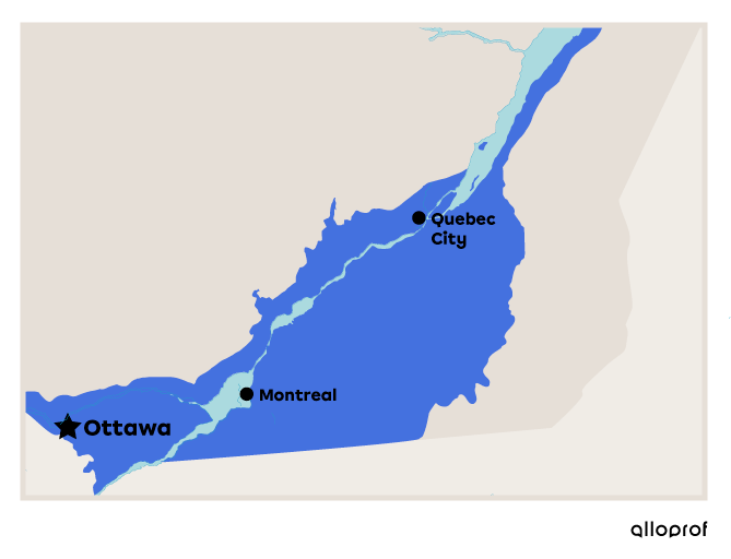
Quebec's St. Lawrence Lowlands physiographic region has some of the most fertile land in the province. That's why a large part of its farmland is located here.

Source des données : Government of Canada, 2016
Why is this land so fertile compared with other areas? The answer can be found in the evolution of the region over time.
Some 12 000 years ago, this region was covered by the Champlain Sea. This means that the present-day site of Montreal and Ottawa were submerged under a hundred metres of water. When the Sea disappeared 9 800 years ago, it left behind a lot of sediment (i.e., mineral deposits) as well as plant and animal particles. This is what makes the land in the region so fertile today.
The study of natural and human phenomena over time is a very broad subject. This is why geography is divided into two different fields: physical geography and human geography.
Physical geography concentrates on the different components of the Earth's surface, such as relief, climate, continents, hydrography, vegetation, etc.
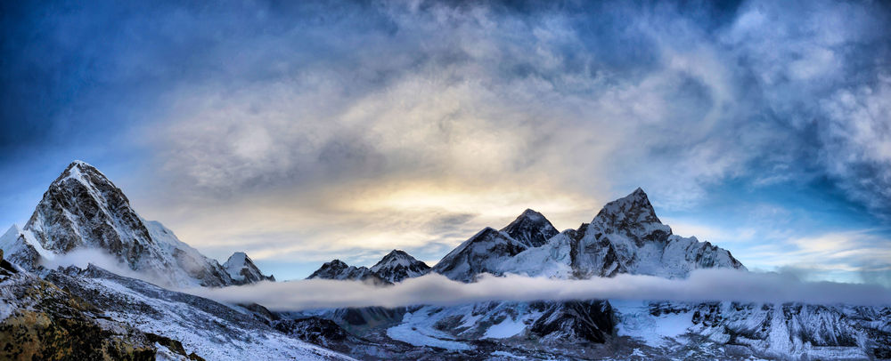
Relief is studied in the field of physical geography, for example the creation of mountain ranges such as the Rockies, the Himalayas, the Alps and the Andes.

The Himalayan mountain range is located in Asia. This range includes Mount Everest, the highest peak in the world.
Source : SIHASAKPRACHUM, Shutterstock.com
Hydrography is a branch of physical geography that studies oceans, seas, lakes, etc.
It is in southern Africa that the River Zambezi transforms into a waterfall (Victoria Falls) and then continues on its way before flowing into the Indian Ocean. The Zambezi, 2 660 kilometres in length, is the fourth longest river on the African Continent. Victoria Falls form the largest curtain of water in the world. In other words, it is the widest set of waterfalls on the planet, at 1 708 metres. Victoria Falls has been a UNESCO World Heritage Site since 1989.
Climate and vegetation are also areas of study in physical geography. In fact, the climate of a region has a major influence on the type of vegetation found there.
The influence of climate on vegetation can be seen in the Amazon rainforest. The Amazonia climate is equatorial, meaning that temperatures are warm throughout the year and there is a lot of precipitation. This creates a warm, humid environment that is home to a wide variety of wildlife and flora. The Amazonia is home to over 10% of the world's biodiversity, including 40 000 plant species, 3 000 fish species and several hundred thousand other species, the majority of which are still unknown[1].
Human geography, as its name suggests, focuses on the relationship between human populations and natural environments. It studies these populations and their use of the land. This field of geography seeks to understand how humans appropriate and occupy the land, transforming it into a developed territory.
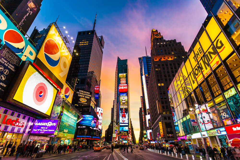
Human populations modify the land to meet their needs (for living, cultivating and exploiting a resource). For example, New York City has developed over the years as a result of the increase in the number of inhabitants. Today, it is one of the world's largest metropolises.

Source : Times Building, New York, N.Y. [Photography], Detroit Publishing Co., 1908, PICRYL, (URL).

Source : Tinnaporn Sathapornnanont, Shutterstock.com
Metropolises are not the only areas that change to better meet human needs. In fact, there are several types of territory that are organized and developed to meet a particular need. This is the reasoning behind the high school geography program.
Each geography module presents a type of territory and covers both physical and human geography, since the two are linked. However, the geography program focuses on human geography.
A territory is a delimited geographical space that humans occupy, use, organize and transform over time to meet their needs.
Studying a territory helps us to understand the world in which we live. The territories studied are divided according to the organization of the space and the main activities found there.
|
Urban Territory |
An urban territory is one where there is a large concentration of habitants. In other words, it is an area where there is a city. |
Cities Subject to Natural Hazards
|
|---|---|---|
|
Agricultural Territory |
An agricultural territory is an area where there is a concentration of activities linked to food production. It is a rural area where there are many infrastructures linked to agricultural activities. |
Agricultural Space Environment at Risk |
|
Regional Territory |
A regional territory is an area that uses its resources to develop various economic activities, such as the exploitation of forests, tourism and industrial and energy production. |
Energy-Producing Regions Industrial Regions |
|
Protected Territory |
A protected territory is an area whose purpose is to preserve and protect the natural heritage from the various threats that can endanger it. |
Natural Parks |
|
Indigenous Territory |
Indigenous territory is a territory inhabited and occupied by Indigenous people. |
There are many tools that are important when studying geography. This section presents and explains the tools and the basic knowledge required.
[1] WWF. (n.d.). Amazonie : Poumon vert de la planète. https://www.wwf.fr/espaces-prioritaires/amazonie
Government of Canada. (2016, October 7th). Basses terres du fleuve Saint-Laurent. Statistics Canada. https://www150.statcan.gc.ca/n1/pub/11-402-x/2012000/chap/geo/geo02-fra.htm
Detroit Publishing Co. (1908). Times Building, New York, N. Y. [Photography]. PICRYL. https://picryl.com/media/times-building-new-york-ny


