To access the rest of the unit, consult the Tools in Geography concept sheet.
Physiographic regions are distinguished from one another by physical characteristics such as relief and soil composition. The geology of each region is unique.
Geology is the science that studies the composition and evolution of the Earth.
Canada has seven physiographic regions.
-
The Canadian Shield
-
The Hudson Bay Lowlands
-
The Arctic Lands
-
The Inland Plains
-
The Cordillera
-
The St. Lawrence Lowlands - Great Lakes
-
The Appalachians (Appalachian Highlands)
Three of these regions are partly or wholly located in Quebec.
-
The St. Lawrence Lowlands
-
The Canadian Shield
-
The Appalachians
* The information in the map’s legend contains an error. Hudson Bay Lowland is plural not singular (Hudson Bay Lowlands).
The physiographic region of the St. Lawrence Lowlands lies to the south of the province of Quebec, more precisely around the St. Lawrence River. However, its surface area extends beyond the province of Quebec. In fact, the lowlands stretch from Quebec City to Brockville, Ontario, via the northern United States. The majority of its area, 41 000 km2 out of 46 000 km2, however, lies in the province of Quebec[1].
The soil in this region is mostly composed of sedimentary rocks. This is the result of many years of erosion and marine deposits of the former Champlain Sea, which once covered the present-day St. Lawrence Lowlands.
Erosion is the degradation of soil by wind, water or human action.
This region is characterized by its relatively flat relief with an average altitude below 100 m. In addition to this flat relief, there are a few hills with altitudes of up to 150 m[1].
The main watercourse in the St. Lawrence Lowlands is the St. Lawrence River. Other waterways include rivers, such as the Ottawa River, and a few small lakes.

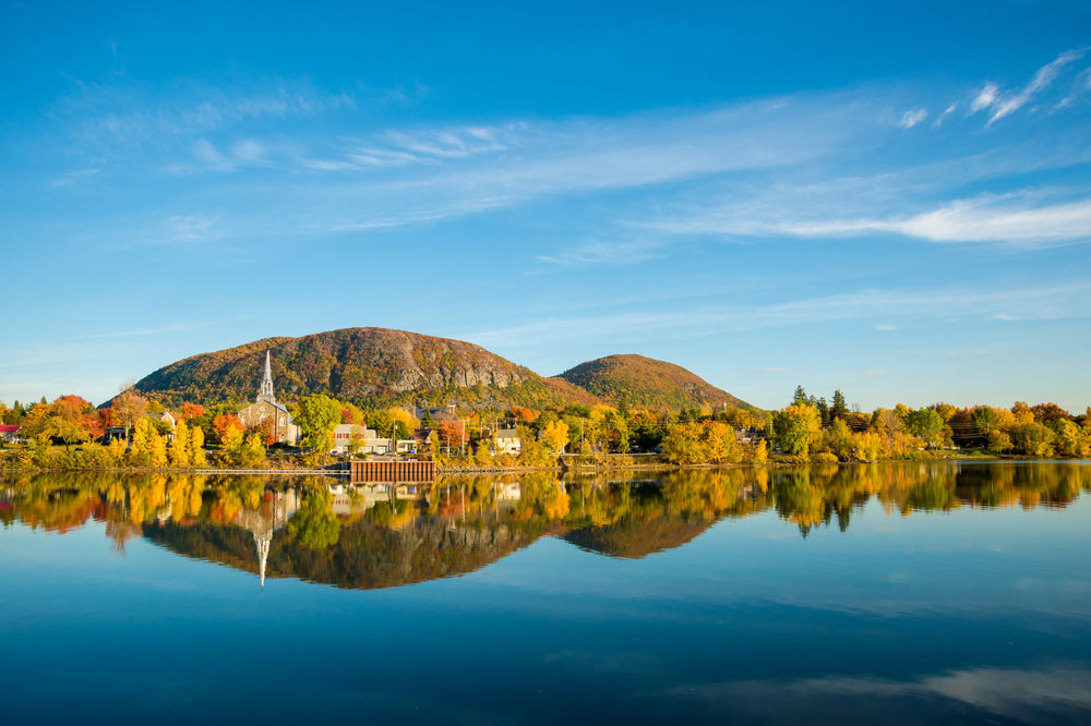
This mountain is one of the hills in the St. Lawrence Lowlands region.
Source : Marc Bruxelle, Shutterstock.com
The geographic location of this region means that the climate is predominantly mild and humid, which is conducive to the development of a diverse flora. In fact, this part of the province of Quebec is marked by a mixed forest cover, with several types of deciduous trees such as birch, poplar, sugar maple and basswood, as well as conifers such as fir and various types of spruce.
-
Forest cover refers to forest that covers a territory.
-
Altitude represents the elevation (height) of a site in relation to sea level.
The region's climate, combined with its fertile soil, makes it ideal for farming. Over 50% of the Lowlands region is covered with farmland[2].

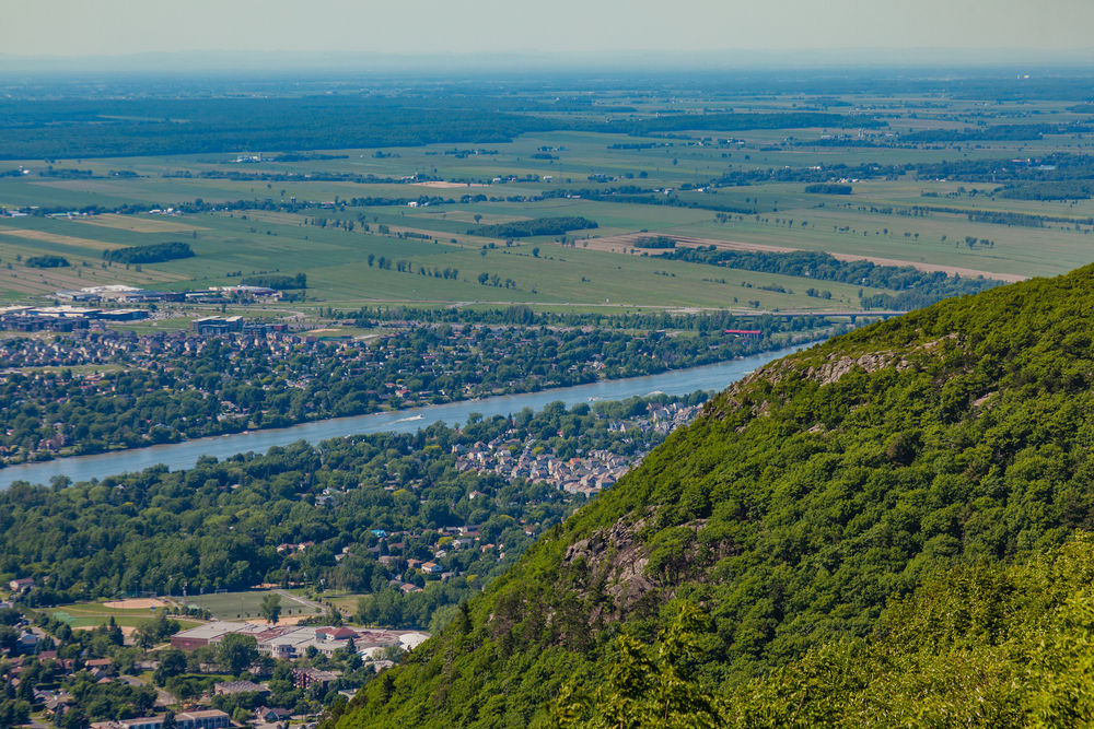
This photo was taken from the top of one of the hills in the lowlands. In the distance you can see farmland, a typical landscape of this physiographic region.
Source : Alina Reynbakh, Shutterstock.com
This physiographic region is the most populous in Quebec, and among the most densely populated in Canada. It is home to major cities such as Ottawa, Montreal, Trois-Rivières and Quebec City.
Agricultural activities combined with high population density mean that there is little forest cover in this region.
The Canadian Shield covers most of Quebec. It lies north of the St. Lawrence River and extends as far as Hudson Bay.
This region began to form over 3 billion years ago[3]. The Canadian Shield extends over a vast territory and its soil contains igneous, metamorphic and sedimentary rocks. Many of these rocks date from the Precambrian era[4].
Rocks 4 billion years old have been found in the Canadian Shield[5]. They are the oldest known rocks on Earth.
The Canadian Shield is relatively flat and hilly.
It is marked by the presence of numerous lakes. During the last ice age, the Canadian Shield was covered by a thick layer of ice. The ice eroded holes in the Shield. Later, these holes filled with water, creating lakes.
The Canadian Shield is occupied by the boreal forest (also called taiga), which contains mostly conifers, such as fir and black spruce, as well as the tundra that lies to the north of the boreal forest.

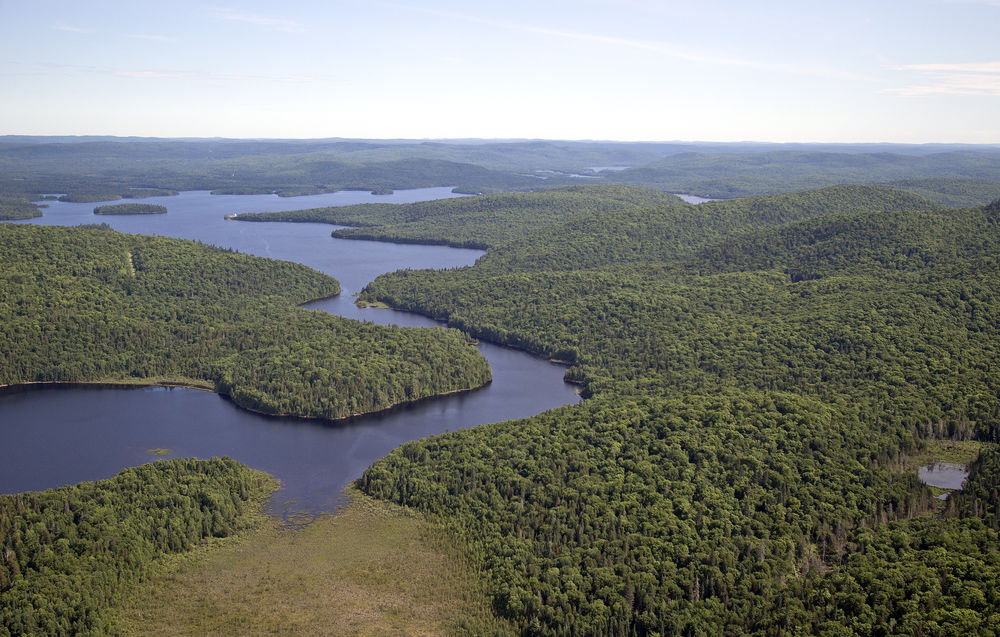
This landscape is characteristic of the Canadian Shield, with its flat terrain, predominantly coniferous forest and bodies of water.
Source : gdvcom, Shutterstock.com
The Canadian Shield region boasts a wide variety of natural resources, from timber and freshwater to minerals, such as silver, gold, zinc and copper. The exploitation of these natural resources is important to the economy of both Canada and Quebec.
The relief of the Appalachians is mountainous, made up of hills and mountains, including the region's highest peak, Mont Jacques-Cartier, at 1270 m in altitude[6].
The mountain range that crosses the region was formed between 450 and 290 million years ago[7]. Several million years ago, it was much larger than it is today. Phenomena such as erosion have altered the range's altitude over time.

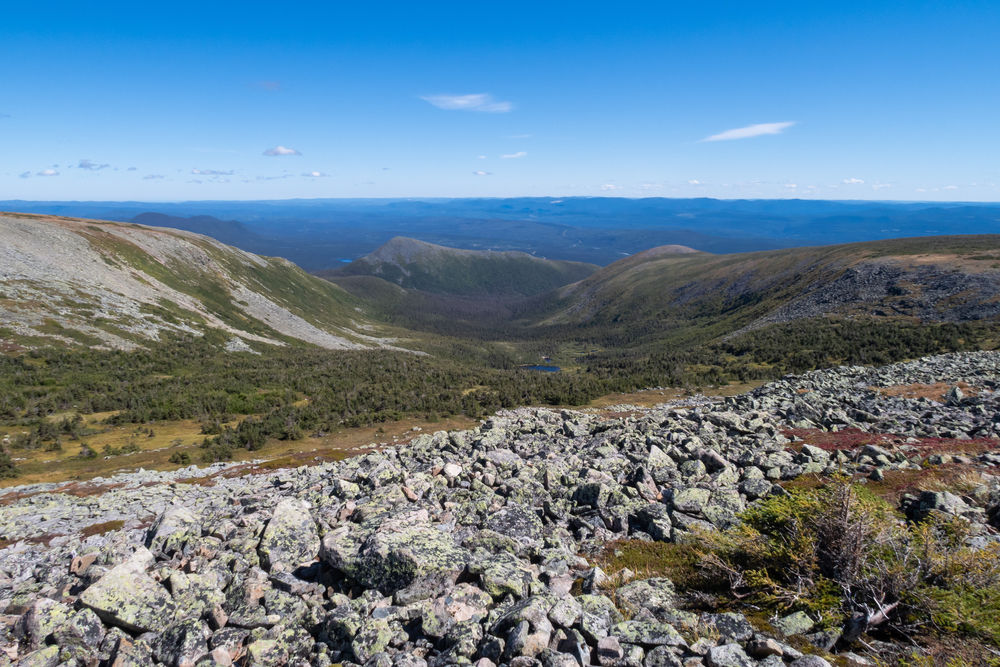
This photo taken on Mont Jacques-Cartier gives a view of the Appalachian Mountains landscape.
Source : Awana JF, Shutterstock.com
The Appalachians cover an area that extends beyond the borders of Quebec. They stretch from Newfoundland (in Canada) to Alabama (in the USA). In Quebec, they stretch along the St. Lawrence River from the Eastern Townships to the Gaspé Peninsula.
This region is mainly composed of sedimentary rocks and igneous rocks (also known as volcanic).
Due to its wide variation in altitude, the climate in this region of Quebec tends to be changeable. In the southwest, it is milder, while in the northeast, it is harsher (cold temperatures, high humidity, strong winds, presence of fog, etc.)[7].
This region is made up of a temperate forest with mixed forest cover and, to a lesser extent, the boreal forest.
The flatter parts of the territory are used for agriculture. However, the territory's economic activities are primarily logging, mining and tourism.
For more information, please consult the following concept sheets.
To access the rest of the unit, consult the Tools in Geography concept sheet.
1. Elson, J.A. (2019, May 15). St. Lawrence Lowlands. Canadian Encyclopedia. https://www.thecanadianencyclopedia.ca/en/article/st-lawrence-lowland
2. Li, T. and Ducruc, J. P. (1999). Les provinces naturelles. Niveau 1 du cadre écologique de référence du Québec. Ministère de l’Environnement. https://www.environnement.gouv.qc.ca/biodiversite/aires_protegees/provinces/partie4b.htm
3. Barrett, D. (2022). Canadian Shield. Canadian Encyclopedia. https://www.thecanadianencyclopedia.ca/en/article/shield
4. Ministère du Développement du Nord, des Mines, des Richesses naturelles et des Forêts. (2012, 25 mai). Géologie du substrat rocheux. Gouvernement de l’Ontario. https://www.mndm.gov.on.ca/fr/mines-et-des-mineraux/geologie/geologie-du-substrat-rocheux
5. Government of Canada (2017, March 3). 126. Acasta Gneiss (1983). https://science.gc.ca/site/science/en/educational-resources/history-geological-survey-canada-175-objects/126-acasta-gneiss-1983
6. Ministère des Forêts, de la Faune et des Parcs (n.d.). Parc national de la Gaspésie. Government of Quebec. https://www.quebec.ca/en/agriculture-environment-and-natural-resources/environmental-protection/national-parks-network
7. Li, T. and Ducruc, J. P. (1999). Natural provinces. Niveau 1 du cadre écologique de référence du Québec. Ministère de l'Environnement. https://www.environnement.gouv.qc.ca/index_en.asp
Data source for the map Physiographic regions of Canada.
Canadian Geospatial Platform Services ArcGIS Online (2019, October 3). Physiographic regions of Canada.