To access the other concept sheets in the Metropolis module, check out the See Also section.
The territory of a metropolis must be planned and developed so that it is attractive and functional for the people living there. Different neighbourhoods, with various purposes, are developed and interconnected by transportation infrastructure. Each metropolis is also planned and developed according to its geography, climate and other features.
Just as the city of Cairo, in Egypt, must adapt to the fact that it is bordered by the desert, which limits its expansion, Montreal must adapt to special winter conditions.
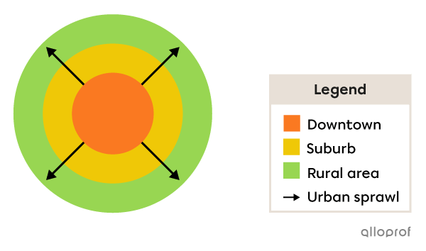
In the planning and development of a metropolis, it is also important to take into account urban sprawl in order to ensure that the more central neighbourhoods are connected to those further away.
-
Planning and development is the modification or transformation of a territory with the goal of making it accessible, functional and usable.
-
Infrastructure refers to a structure or set of structures (roads, bridges, buildings, aqueducts, etc.) that enable the planning and development of a territory.
-
Urban sprawl is the spreading of a city over an increasingly larger area.
Types of neighbourhoods are similar from one metropolis to another. Even if two industrial neighbourhoods are planned and developed differently, they still play the same role within the city.
It is also important to take into consideration a country’s level of development. There are certain differences between neighbourhoods in the metropolis of a developed country and those in the metropolis of a developing country.
Some of the neighbourhoods in the metropolises of developing countries are slums. This type of neighbourhood does not exist in the metropolises of developed countries.
Level of development of a country refers to the wealth and living conditions of its population, such as quality of life, level of education and life expectancy.
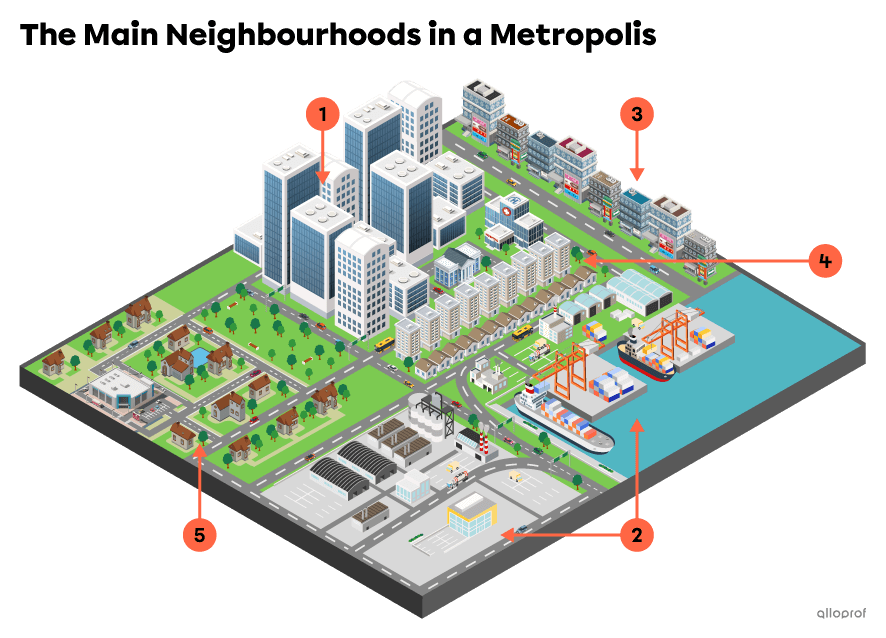
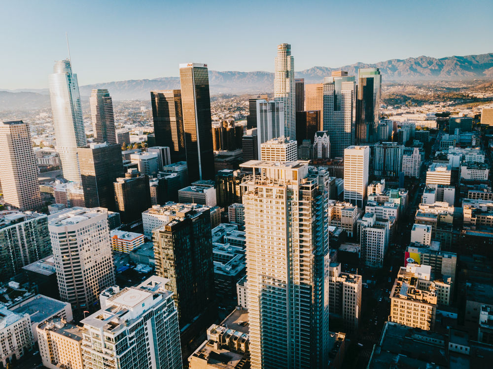
This is the liveliest neighbourhood, where most cultural activities take place. Downtown tends to represent the city’s business centre, home to most of the head offices of big companies. As a result, many jobs are also located there.
Downtown Los Angeles is the metropolis’s business sector. This neighbourhood is also an important cultural centre, with theatres and museums, including The Broad, a contemporary art museum.
This type of neighbourhood is composed of various industries that process raw materials, as well as warehouses, technology companies and other businesses.
Kya Sand is an industrial neighbourhood in the metropolis of Johannesburg, in South Africa. It is the site of many businesses, such as Autopac Machinery. This type of business manufactures machines used to fill and seal bags of food, also known asAR industrial Supplies, and specializes in the production of welding equipment.
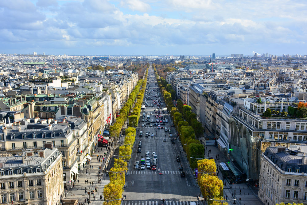
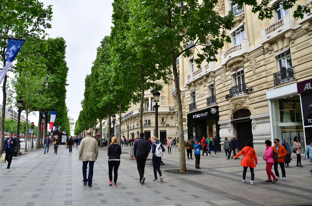
This type of neighbourhood is mostly occupied by merchants, and has many stores and restaurants.
In the commercial neighbourhood of Champs-Élysées, in Paris, most of the stores are located along the famous avenue by the same name. Many luxury boutiques, restaurants, movie theatres and other entertainment venues can be found in this sector of the city.
People who are economically and socially disadvantaged tend to live in poorer neighbourhoods. People can be disadvantaged in various ways, in particular when they have an income that is below average, or live in housing that is in below-average condition. Housing in these neighbourhoods is generally more affordable, but less well maintained. There are many housing units, built very close together, which makes these neighbourhoods very densely populated. Disadvantaged neighbourhoods are also marked by unemployment, poverty and criminality.
The London neighbourhood of Barking is one of the most disadvantaged in the metropolis. In 2020, 7.2% of its inhabitants were unemployed, which is much higher than the country’s average of 3.9%.[1]
Unemployement refers to a period during which a person is without a job, but is able to work and is actively looking for a job.
This type of neighbourhood is located on the edge of the metropolis. Suburban neighbourhoods tend to develop horizontally: the houses have fewer floors and are at a greater distance from each other. Neighbourhoods closer to downtown tend to develop upward. Consequently, the density of a suburb is lower than that of other types of neighbourhoods since one house usually accommodates one family (or group of people), while a building has several storeys and accommodates many families (or groups of people). Suburbs also have a lower concentration of activities and services.
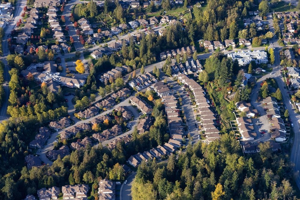
A residential neighbourhood in Maple Ridge City, a Vancouver suburb.
Source: EB Adventure Photography, Shutterstock.com
A suburb is considered a type of neighbourhood. It can also be a city in itself, and still be a suburb of a metropolis. For example, Longueuil is a city, but it is also considered a suburb of Montreal.
Gwangmyeong is a suburban city south of Seoul, in South Korea.
This type of neighbourhood is specific to developing countries. Slums are residential neighbourhoods on the outskirts of cities. Housing in slums is unsanitary, meaning that it can be harmful to the health of the people living there. If you would like to learn more about slums, watch the videos below.
-
A slum is a living area close to a metropolis where very poor people live. Slums have few or no basic services (water, sewers, electricity, etc.).
-
Unsanitary refers to something that is a health risk. A place is considered unsanitary when it is dirty and a health hazard (presence of mould, pest infestation, etc.).
-
A developed country is an industrialized country where the population generally has a high standard of living.
-
A developing country is a country where the population generally has a low standard of living.
The presence of different cultures in one city leads to the creation of a variety of neighbourhoods characterized as ethnic. This can be explained by their residents finding support and community in certain neighbourhoods, designated as Chinese Neighbourhoods or Italian Neighbourhoods.
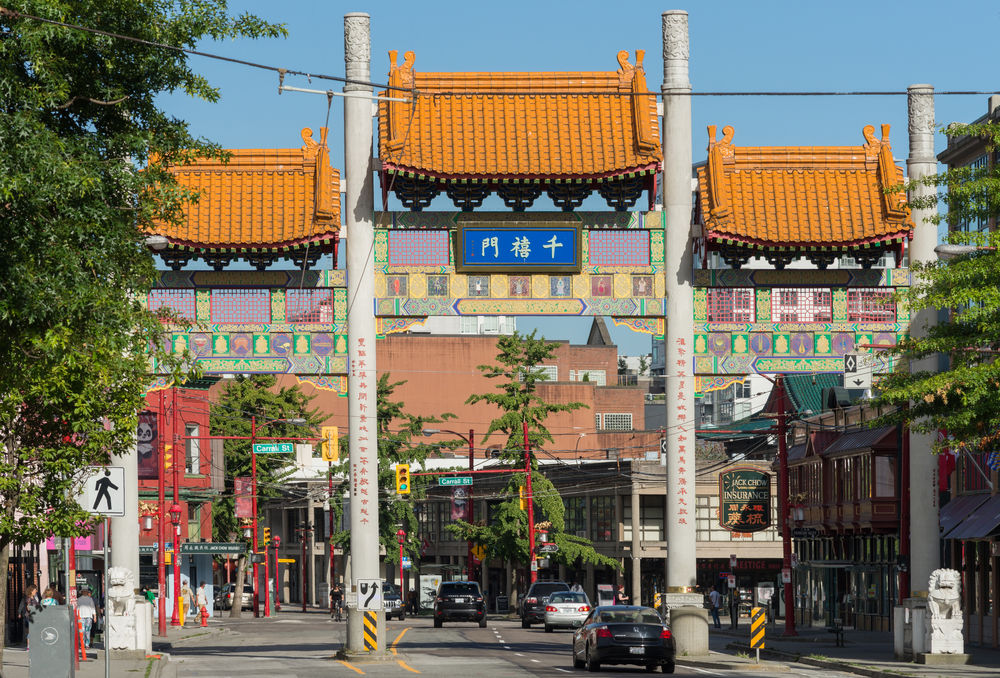
Source: Claudine Van Massenhove, Shutterstock.com
Multiethnicity characterizes a population composed of people of different cultures or from different origins living in the same area.
An interactive map illustrating the native tongue of every Canadian was created based on the 2016 Canadian census. It clearly illustrates that people living in metropolises are from much more diverse ethnic origins than those living in the other cities and towns.
To view this map, see the following concept sheet: Maps tell story of Montreal's changing linguistic landscape
Transportation is a very important aspect of the planning and development of a metropolis, and allows for the efficient movement of people and goods between the different neighbourhoods.
Take, for example, the make-believe metropolis of Cactustown. Every morning, many people from Cactustown have to go to work.
-
Prickly Cactus lives downtown and works in the industrial neighbourhood.
-
Tall Cactus also lives downtown and works there.
-
Wide Cactus lives in the suburbs and works downtown.
-
Round Cactus also lives in the suburbs and works in the industrial neighbourhood
There are millions of people like them who also travel each morning. Therefore, it is important that the transportation infrastructure in Cactustown be planned and developed to ensure the quickest and most efficient movement possible for the benefit of its population and businesses.
Transportation infrastructure includes roads, highways, railways and tramways, which are used by people in cars and public transit to travel throughout the metropolis.

Source: Melinda Nagy, Shutterstock.com
Metropolises have large public transit networks serving the city’s various neighbourhoods. The networks are often more concentrated in the neighbourhoods around downtown, and more dispersed in the neighbourhoods located on the edge of the city.
With urban sprawl, transportation infrastructure must be reviewed and improved so that all neighbourhoods, including suburbs, can benefit from the many connections between them.
To access the rest of the module, you can consult the following concept sheets.
1. Carlier, R. (2020, 28 janvier). À Barking, quartier populaire de Londres, « les éternels laissés-pour-compte » du Brexit. France 24. https://www.france24.com/fr/20200128-%C3%A0-barking-quartier-populaire-de-londres-les-%C3%A9ternels-laiss%C3%A9s-pour-compte-du-brexit
