To access the other concept sheets in the Tourism module, consult the See Also section.
The Îles-de-la-Madeleine form an archipelago of 12 islands in the Gulf of St. Lawrence. Many of the islands are connected by dunes or bridges. The islands cover an area of 202 km2 [1] and are located around 200 km southeast of the Gaspésie coast. It's possible to get there by plane or ferry.
These islands are part of the tourist region of Îles-de-la-Madeleine.
An archipelago is a group of islands.

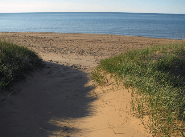
The Îles-de-la-Madeleine region is a very popular tourist destination in Quebec. The islands welcomed 63 250 tourists[2] in the summer of 2019. With impressive landscapes and 300 km of beach around the islands, the region attracts many people looking for beach tourism, ecotourism or adventure tourism[3].
The Îles-de-la-Madeleine region is unique in that its beaches are relatively windy, allowing for a variety of activities such as windsurfing, flyboarding (kitesurfing) or sailing excursions. There's also sea kayaking, canoeing and scuba diving.
Several forest trails are ideal for hiking, horseback riding and cycling.
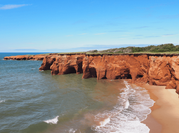
This cove features a magnificent beach that stretches out at the foot of a steep cliff. It offers spectacular scenery.
This island is located towards the south of the archipelago. It is home to the largest forest in the Îles-de-la-Madeleine, as well as several cafés, boutiques and cultural venues.

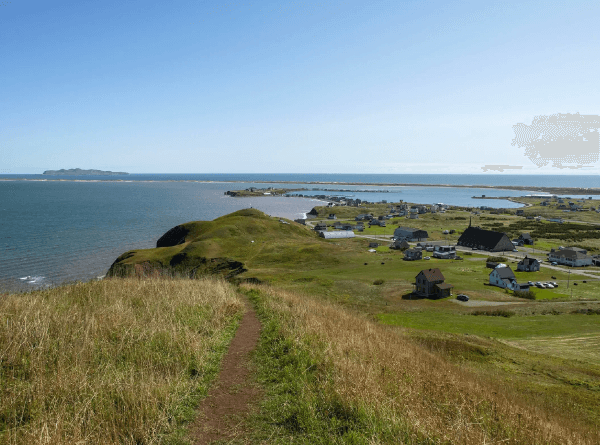
Île du Havre aux Maisons offers wonderful panoramic views. There are many houses with traditional Îles-de-la-Madeleine architecture.
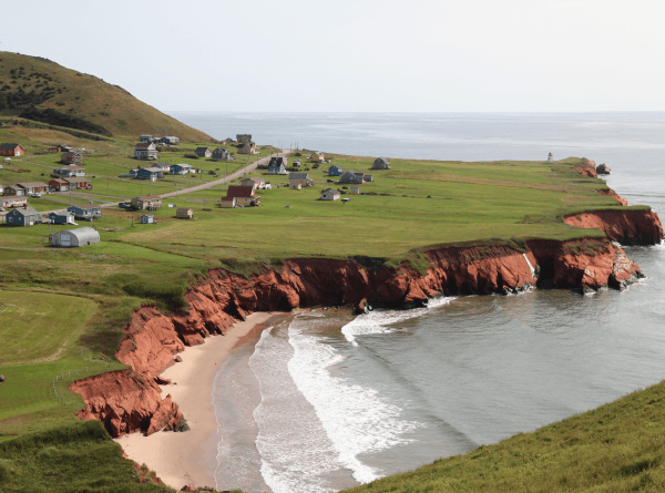
Source : Village Havre-aux-Maisons, Îles-de-la-Madeleine, Canada [Photograph], Marc-Lautenbacher, 2018, August 20th, Wikimedia Commons, (URL). CC BY 4.0[4].
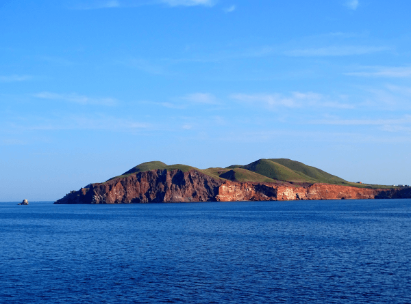
Île d'Entrée has an area of 7 km2[5]. It is the only inhabited island not connected to the rest of the archipelago by land. The inhabitants’ main livelihood is fishing.
A wide variety of seafood and fish: lobster, crab, scallops, mussels, halibut and mackerel, among others, can be enjoyed in the Îles-de-la-Madeleine thanks to local fishing.
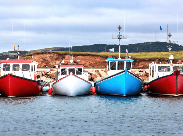
Source : Jane Rix, Shutterstock.com
Tourism is the second most important economic activity in the region. As a result, several infrastructures have been built to welcome tourists all year round.
Several amenities had to be built so that tourists could easily access the islands. The ferry increased its transport capacity, since 80% of tourists prefer this mode of transportation[3]. The port of Cap-aux-Meules has also been designed to accommodate cruise ships. The islands are also accessible by airplane, as there is an airport at Havre-aux-Maisons. A single road links the islands, Route 199, and tourists can get around by:
- car
- bus
- public transport
- bike
The archipelago offers several accommodation options. There are a few hotels, but B&Bs, inns, cottages and camping remain the most popular choices among tourists. Îles-de-la-Madeleine has several restaurants, highlighting seafood and local produce.
Infrastructure has been put in place to showcase the archipelago's landscapes and attractions, such as:
- walkways
- forest trails
- marked dune trails
- campsites
- equipment rental facilities (cycling, diving, aquatic activities)
Various tours are organized to showcase the activities available
The Circuit des Saveurs offers a chance to meet the many local producers and craftspeople of the Îles-de-la-Madeleine. The tour takes in the wharves, farms, cafés and restaurants, the smokehouse and the market.
Source : Circuit des Saveurs [Online Image], (n.d.), Tourisme Îles de la Madeleine, (URL). Rights reserved*[6]
The Sentiers Entre Vents et Marées were set up by the inhabitants of the islands. The route is 230 km long and circles the island. It has 56 km of beach, 83.5 km of paved roads, 61.5 km of trails and 30.5 km of unpaved roads[7].
Source : Sentiers entre Vents et Marées [Photographie], (n.d.), Bonjour Québec, (URL). Rights Reserved*[8]
The Circuit des Arts features some 15 art stores, studios and galleries, showcasing the work of artists and artisans from the islands.

Source : Circuit des Arts [Online Image], (n.d.), Tourisme Îles de la Madeleine, (URL). Rights Reserved*[9]
The Îles-de-la-Madeleine also organize an array of festivals and events to attract tourists such as the Festival acadien, the Festival littéraire des Îles, the Festival de Cirque des Îles, the Concours de Châteaux de Sable des Îles and many others.
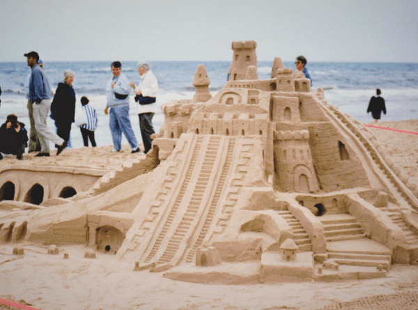
Source : Château de sable [Photo], (n.d.), Corporation des Châteaux de sable des Îles, (URL). Rights Reserved*[10]
The presence of large numbers of tourists on the Îles-de-la-Madeleine makes managing drinking water and waste more difficult.
The archipelago's fragile ecosystems are also affected since they deteriorate rapidly if they are over-visited. A number of measures have therefore been put in place to prevent, or at least slow down, this degradation, such as:
- a ban on driving off marked paths from spring to autumn
- a ban on the use of motorized vehicles on certain beaches during the same period
These measures aim to protect certain sand dunes, their vegetation and seabird nesting sites.
Vegetation helps prevent the erosion of dunes.
Source : Angelique clic, Shutterstock.com
Another threat to the Îles-de-la-Madeleine is the erosion of the riverbanks (or shores). Year after year, a part of the territory is washed away by the sea. Infrastructures such as buildings and roads are at risk due to the fact that the land on which they are located is disappearing.
Erosion is the degradation of soil by wind, water or human action.
The Canadian government aims to protect 30% of its marine environments by 2030. To achieve this, it wants to create a 17 000 km2 marine protected area around the Îles-de-la-Madeleine[11]. This area will become the largest protected marine area in the province of Quebec.
A study to determine the feasibility of this protected marine area was carried out to determine the constraints and make recommendations concerning its management. The study was carried out by Parks Canada and the Ministère de l'Environnement et de la Lutte contre les changements climatiques, de la Faune et des Parcs du Québec.
A concertation committee was also set up to ensure that the interests of all sectors were taken into consideration (fishing, environmental protection, etc.). Once approved by this committee, the project will also be submitted to the public.

Roads had to be moved due to coastal erosion.
Source : Adrien Le Toux, Shutterstock.com
One of the causes of this erosion is the lack of protection of the coast during winter. In the past, the archipelago was surrounded by ice in winter, which protected the coasts. Today, there is hardly any ice left to fulfill this role. Another cause is rising sea levels. The higher the water level, the more extensive the erosion.
Certain protective measures are put in place to try and protect the coasts of the Îles-de-la-Madeleine. One such measure involves adding pebbles (or cobbles) to the beaches. Pebbles form a protective barrier, helping to preserve cliffs and shorelines.
The Îles-de-la-Madeleine are facing a housing crisis. Low housing availability and high house prices mean that it can be very difficult for residents to find accommodation on the archipelago. Tourism makes this situation worse, since many accommodations are reserved for tourists. This also adds to the problem of the shortage of workers. In fact, although some people would like to come and work in the region, they have too much difficulty finding affordable housing.
The apartment shortage
The number of apartments is very limited in the Îles-de-la-Madeleine. 85% of the real estate market is made up of single-family homes[12]. In addition, several units are used during the tourist season to house tourists. As a result, residents sometimes have to leave their apartments for several months during the summer.
This is known as "hidden homelessness". The inhabitants often find themselves having to camp outside or live in their car or a trailer during the summer. This can be particularly difficult for families. People often feel obliged to accept these conditions, as there is very little housing available.
Rising house prices
The Îles-de-la-Madeleine have been experiencing a rise in house and land prices in recent years. The construction of cottages dedicated to tourists and the purchase of second homes by people from outside the islands are causing house values to rise. Over time, residents may be forced to leave the archipelago since they won't be able to find a place to stay.
In 2021, 82 new homes were built on the archipelago, and nearly 500 new homes could be built by 2031[13]. However, this creates a problem of space. Indeed, on an archipelago of some 200 km2, space is limited, and these new constructions must be carried out in a sustainable manner, by protecting the many landscapes, fragile ecosystems as well as agricultural land.
A number of solutions have been put in place to address these issues:
- Between 2020 and 2022, the municipality invested over $1 million to create morehousing[12].
- The Îles-de-la-Madeleine also banned the conversion of second homes into tourist accommodations (such as Airbnb).
- In 2022, a construction freeze on homes as well as forest and agricultural areas was put in place in order to find a way to ensure the sustainable development of the island.
To access the rest of the module, please consult the following concept sheets.
-
Tourisme Îles de la Madeleine. (s.d.). Paysages. https://www.tourismeilesdelamadeleine.com/fr/decouvrir-les-iles/particularites-regionales/paysages/
-
Larose, Isabelle. (2021, 21 octobre). Bilan touristique des Îles: 10% moins de visiteurs en 2021 qu’en 2019. Radio-Canada. https://ici.radio-canada.ca/nouvelle/1833550/bilan-touristique-iles-de-la-madeleine-2021
-
Boisvert, C., Roy-Cadieux, F., Krysztofiak, V., Poulou-Gallet, C., Riendeau, J. et Ste-Marie, P. (2015). Espace Temps - 1re secondaire [cahier de savoirs et d’activités]. ERPI.
-
Marc-Lautenbacher. (2018, 20 août). Village Havre-aux-Maisons, Iles des la Madeleine, Canada [Photographie]. Wikimedia Commons. https://commons.wikimedia.org/wiki/File:Village_Havre-aux-Maisons,_Iles_des_la_Madeleine,_Canada.jpg
-
Tourisme Îles de la Madeleine. (s.d.). Île d’Entrée. https://www.tourismeilesdelamadeleine.com/fr/decouvrir-les-iles/les-iles/ile-d-entree/#carte
-
Tourisme Îles de la Madeleine. (s.d.). Circuit des saveurs [Image en ligne]. (URL).*
-
Tourisme Îles de la Madeleine. (s.d.). Sentiers entre Vents et Marées. https://www.tourismeilesdelamadeleine.com/fr/decouvrir-les-iles/experiences/nature/randonnee-pedestre/sentiers-entre-vents-et-marees/
-
Bonjour Québec. (s.d.). Sentiers entre Vents et Marées [Photographie]. (URL).*
-
Tourisme Îles de la Madeleine. (s.d.). Circuit des arts [Image en ligne]. (URL).*
-
Corporation des Châteaux de sable des Îles. (s.d.). Château de sable [Photographie]. (URL).*
-
Shields, Alexandre. (2023, 8 février). Ottawa veut créer une aire marine protégée aux îles de la Madeleine. Le Devoir. https://www.ledevoir.com/environnement/780994/ottawa-veut-creer-une-aire-marine-protegee-aux-iles-de-la-madeleine-d-ici-2025
-
Larose, Isabelle. (2022, 1 août). Pénurie de logements : un autre été difficile aux Îles-de-la-Madeleine. Radio-Canada. https://ici.radio-canada.ca/nouvelle/1901679/penurie-logement-iles-de-la-madeleine-ete-2022-service-aide-logement
-
Larose, Isabelle. (2021, 8 décembre). Boom domiciliaire aux Îles : un territoire à la croisée des chemins. Radio-Canada. https://ici.radio-canada.ca/nouvelle/1846011/construction-maisons-iles-de-la-madeleine-revision-schema-amenagement-parc-regional-eclate-sondage
*Extrait employé par Alloprof conformément à la Loi sur le droit d'auteur dans le cadre d'une utilisation équitable aux fins d’éducation [https://laws-lois.justice.gc.ca/fra/lois/c-42/page-9.html].