Wind is a movement of air caused by a mass of warm air meeting a mass of cold air.
Cold air is denser than warm air. As the warm air rises, an area of low pressure (low air density) is left on the ground. Meanwhile, the cold air descends, creating an area of high pressure (high air density) on the ground.
Air from a high-pressure area always moves towards a low-pressure area. The result is a movement of air: wind. This movement of air is also called a convection cell.
An area of low pressure is also called a depression, while an area of high pressure is sometimes called an anticyclone.
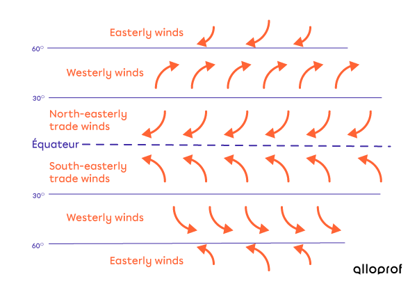
The prevailing winds are large wind corridors whose direction is determined by both convection currents and the Coriolis force.
Depending on where you are on Earth, the prevailing winds will blow in different directions. In the intertropics, the prevailing winds are called trade winds and blow from east to west. Easterly winds are the dominant winds near the poles.
The earth's atmosphere knows no borders, and neither does the pollution it carries. Prevailing winds play a major role in the propagation of pollutants. If there were no winds, the polluted air would fall close to the area where the pollution was produced. But prevailing winds carry these pollutants hundreds of kilometres.
In Quebec, this is an important factor, as a large part of the St. Lawrence lies in the path of the prevailing winds from the United States. The pollutants produced by thermal power stations are transported to our territory where, mixed with precipitation, they produce acid rain.
Local winds are winds that blow over a small area.
Here are the best-known local winds.
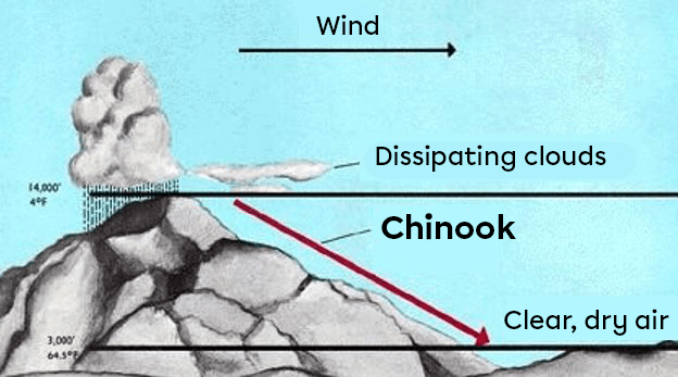
- Chinook is a warm, dry wind from the west that blows east of the Rockies. Moisture-laden air from the Pacific rises as it meets the mountains. As a result, clouds and precipitation affect the western side of the slopes, drying out the air mass. In addition, the air temperature decreases as the mountain rises.
When the air mass descends into the Canadian Prairies and the American Great Plains, it warms up.
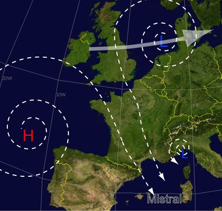
- The mistral is a cool or cold wind, often violent, which affects the north of the western Mediterranean basin. Generally dry and accompanied by very sunny weather, the mistral is caused by the difference in pressure between a high-pressure system over northern Europe and a low-pressure system over the Mediterranean.
- The monsoon is a periodic wind system, particularly active in the Indian Ocean and southern Asia. The winds in these regions undergo seasonal reversals of direction: they blow from the south-west for six months and from the north-east for six months. These cycles lead to very distinct periods of drought or heavy rain.


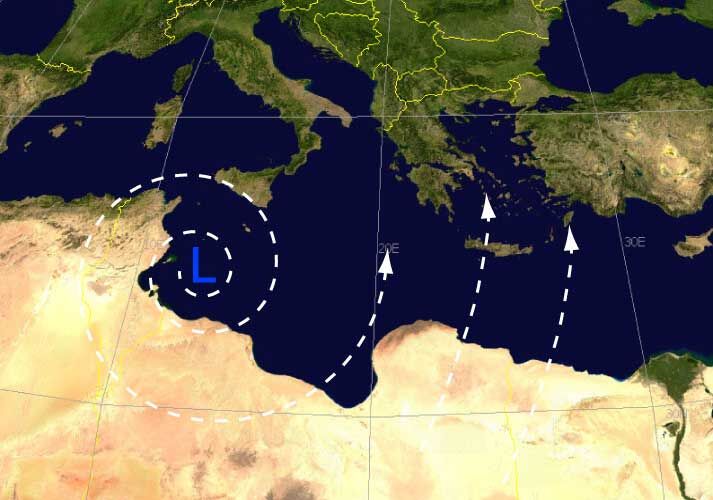
- The sirocco is a violent, very dry and very hot Saharan wind that blows over North Africa and the southern Mediterranean. Sirocco brings very hot, dry and dusty weather to North Africa, while cool, rainy weather will occur in Europe.
- Squamish is a strong and often violent wind that blows across many of British Columbia's fjords. It is produced when a temperate oceanic air mass meets a cold, dry arctic air mass. Snowfalls and episodes of frost are then present in these territories.
A sea breeze is a type of wind that occurs locally (on a small scale). It is a wind that blows from the sea towards the land (the beach) during the day.
In fact, during the day, the Sun's rays fall on the sand and heat up the ground. The air that touches the hot ground also becomes warmer. Warm air is less dense than cold air. It rises, leaving an area of low pressure above the sand.
At the same time, the air that touches the sea is cooled by the fresh water. As the cold air is denser than the warm air, it tends to fall, creating an area of high pressure.
The air always moves from an area of high pressure to an area of low pressure, creating the sea breeze.
An onshore breeze is a type of wind that occurs locally (on a small scale). It is a wind that blows from the land (the beach) towards the sea during the night.
In fact, at night, the sun's rays no longer warm the sand, making it colder. The air that touches the sand is also cooled. As the cold air is denser than the warm air, the result is an area of high pressure above the beach.
Above the sea, the air gradually warms up. The warm air, which is less dense than the cold air, rises and an area of low pressure is created over the sea.
The air always moves from an area of high pressure to an area of low pressure, creating the onshore breeze.
On land, if there is no large body of water nearby, the wind is referred to as a valley wind or a mountain wind.
Valley wind
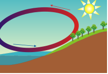
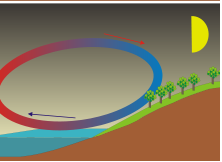
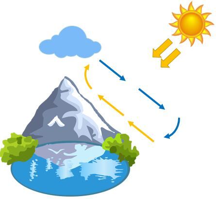
During the day, the slopes of a mountain are exposed to the sun and are thus heated. The air in contact with the mountain heats up quickly and rises. As it rises, it cools and eventually sinks to the ground. A convection cell is formed. This is known as a valley wind. It moves in a counter-clockwise direction.
Mountain wind
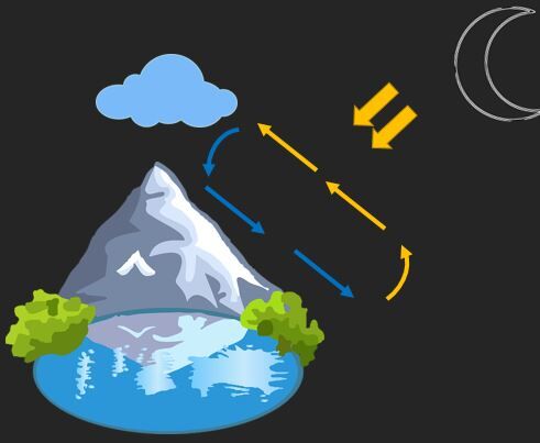
At night, the slopes of a mountain cool rapidly. The air in contact with the darkened slope cools and descends to ground level. The direction of air movement is then reversed from that of daytime movements. This is known as a mountain wind. It moves in a clockwise direction.
Relief has an influence on wind formation. For example, a high mountain range forms a barrier to the wind. The wind has no choice but to follow the slopes. Warm air rising from the ground will thus be forced to rise in altitude along a slope. This phenomenon is known as the barrier effect. As a result, clouds form, sometimes accompanied by rain or snow. Why does this happen? Warm rising air cools as it gains altitude. It takes with it a certain percentage of humidity. At the top of the mountain, the cold air becomes saturated with moisture. This is why clouds form. Once it has been freed of its moisture, the cold air, now dry, descends, but on the opposite side of the mountain. As it descends, the air heats up. The result is a warm, dry wind.
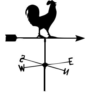
The weathervane is an instrument that indicates the direction of the wind.
This is a pointer (an arrow, a rooster, etc.) mounted on a rotating axis. The pointer can rotate freely around its axis and is therefore aligned parallel to the wind. It is the thinnest part of the pointer (the tip of the arrow, the beak of the cockerel, etc.) that tells us where the wind is coming from. A stationary cross indicating the points of the compass may be fixed under the pointer of a traditional weathervane.
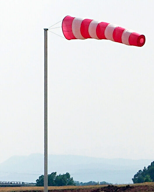
The windsock is an instrument that indicates the origin of the wind and gives an approximation of wind speed.
It's a flexible canvas tube closed at one end (the sleeve) and attached to a mast. The wind rushes through the opening and lifts the sleeve. There are always at least three red stripes and two white stripes alternating. These bands allow us to approximate the wind speed. Each stripe corresponds to a wind speed of 5 knots (about 9 km/h). So, when five strips of the canvas tube are completely horizontal, the wind speed is at least 25 knots (about 45 km/h). The canvas tube can also be rotated on its axis, so you can tell which way the wind is blowing. The sleeve points in the direction of the wind.
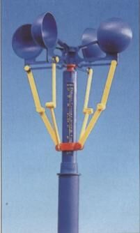
The anemometer is an instrument that indicates wind speed.
The anemometer was invented by the Italian architect Leon Battista Alberti in 1450, and consists of empty half-spherical cups facing in the same direction that rotate freely around an axis. In modern anemometers, an electronic system is used to calculate the number of revolutions made by the cups over a given period of time. The wind speed is then displayed on a small screen.
The Beaufort scale is a scale used to estimate wind strength and speed.
The Beaufort scale is a scale for estimating wind strength and speed, with 12 levels of force. Each of these forces is associated with an approximate wind speed and observable effects.
| Force |
Approximate Wind Speed (km/h) |
Observable Effects |
| 0 | 0 to 2 | Smoke from a chimney or fire rises vertically in a straight line. |
| 1 | 2 to 5 | Smoke from a chimney or fire rises in the same direction as the wind. However, the weathervane does not move. |
| 2 | 6 to 11 | You can feel the wind on his face. The weathervane turns to indicate where the wind is coming from. The leaves on the trees move slightly. |
| 3 | 12 to 19 | The leaves and branches of the trees are in constant motion. Flags unfurl. |
| 4 | 20 to 29 | Dust, leaves and small objects are lifted. |
| 5 | 30 to 39 | The shrubs move slightly. Waves form on inland waters. |
| 6 | 40 to 50 | Big tree branches shake. Umbrellas turn upside down. Telephone wires swing. |
| 7 | 51 to 61 | The trees sway. Walking against the wind is difficult. |
| 8 | 62 to 74 | Walking against the wind is an ordeal. |
| 9 | 75 to 87 | Shingles, house antennae and other structures were ripped off. |
| 10 | 88 to 101 | Trees were uprooted. Houses suffered severe damage. |
| 11 | 102 to 116 | A violent storm hits and the devastation is widespread. |
| 12 | More than 116 | A hurricane hits and devastation ensues. |
When winds exceed 116 km/h, they are known as hurricanes. There is a scale for distinguishing between the different categories of hurricane: the Saffir-Simpson scale. There are five categories, the last of which represents force 5 hurricanes (winds in excess of 250 km/h).
