To access the rest of the unit, consult the Tools in Geography concept sheet.
Canada is a country located in North America that shares its land borders with the United States to the south, and, since June 2022, with Denmark to the north. Canada's other borders are oceanic: the Atlantic Ocean to the east, the Arctic Ocean to the north and the Pacific Ocean to the west. Canada has a surface area of 9,984,670 km2 [1], making it the second largest country in the world in terms of surface area, the first being Russia.
The border between Canada and the United States is the longest international land border in the world. The new border shared with Denmark, on the other hand, is much smaller. It is just a few metres long.
To find out more about the creation of this new border, read the article Canada, Denmark end 50-year “Whiskey War” over Hans Island.
Canada's population in 2021 was estimated at 38 million. Due to the size of the country, the population density is less than 4 people per square kilometre, which is quite low[2].
Population density refers to the average number of individuals living in a given area. It measures the number of inhabitants per square kilometre (inhabitants/km2).
Because of its vast size, Canada has a number of different climates:
- temperate maritime
- continental
- mountain
- polar
Canada's relief is also highly varied, ranging from mountains to vast plains.
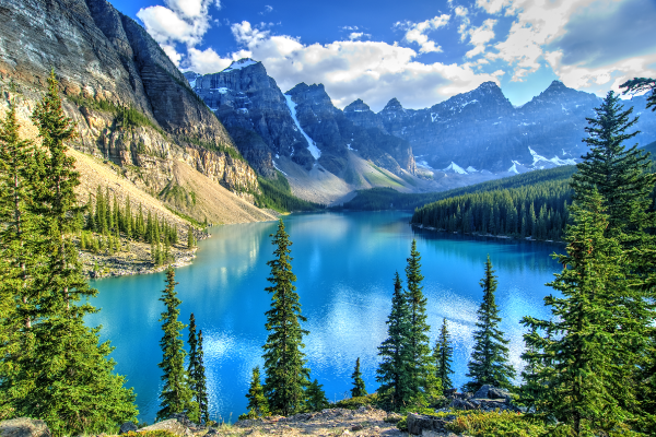
Lake Moraine in the Banff National Park in Alberta.
Source : Krishna. Wu, Shutterstock.com
Politically, Canada is divided into 10 provinces and 3 territories.
The difference comes from the Constitutional Act of 1867. According to the Act:
- the provinces’ powers are defined in the Constitution
- the territories fall under the federal government’s responsibility
A constitution is a legal document, often the founding document of a state or a colony, that determines its structure and how it functions.
It is the federal government that transfers powers to the territories’ governments, since their powers are not established in the Constitution. For example, the government can entrust the management of education to the territory’s government.
Over the years, the federal government has transferred more and more powers to the territorial governments. This process is called devolution.
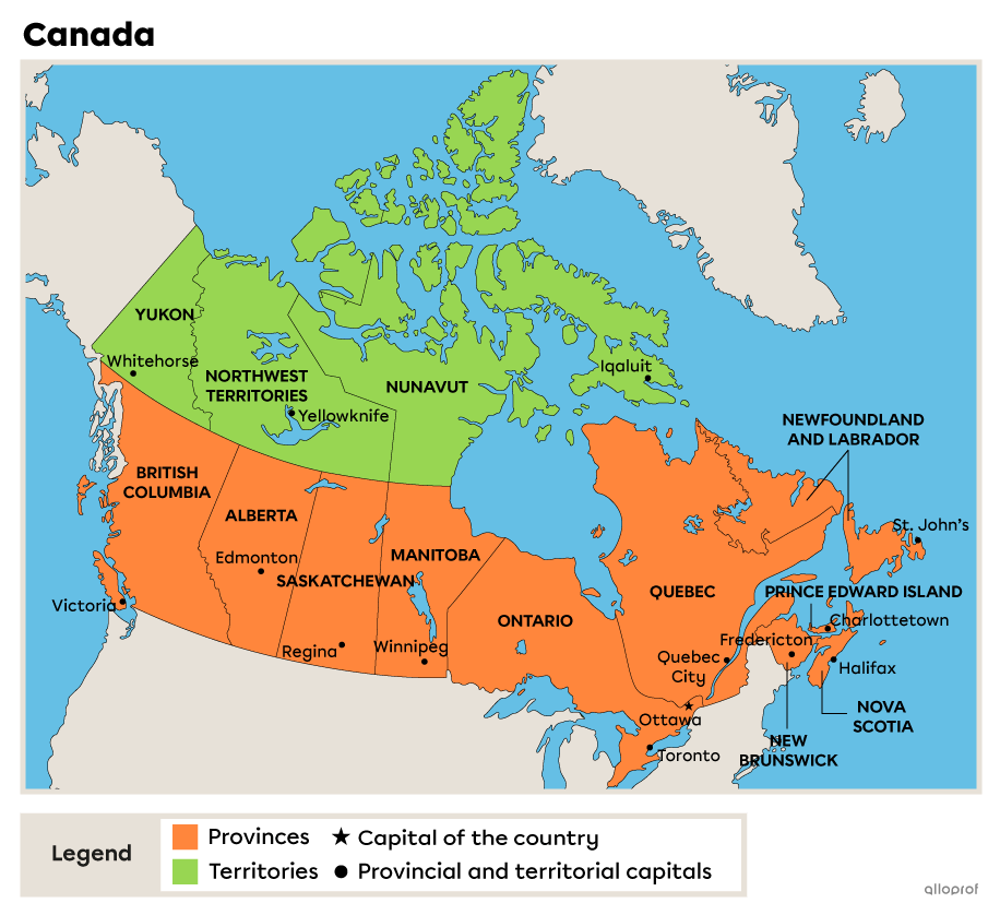
The large size of most of the provinces and territories means that the landscape varies greatly from one province or territory to another. As a result, the elements highlighted for each province or territory are not a complete list of everything that can be found there, but rather an overview of some of those elements.
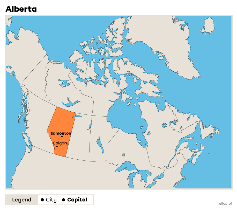
In 2022, Alberta will be the 4th most populated province, with a population of 4 480 486[3]. This province covers 661 185 km2 of the country[4].
Alberta has 3 physiographic regions: the Cordillera, the Canadian Shield and the Inland Plains, which cover most of its territory.
One of the characteristics of Alberta's landscape is the presence of the mountain range known as the Rocky Mountains.
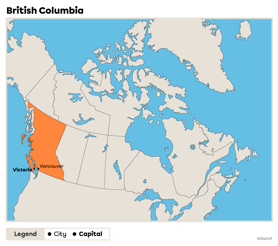
In 2022, British Columbia was the 3rd most populated province, with a population of 5 264 485[3]. This province covers 944 735 km2 of the country[5].
The province is divided between the physiographic regions of the Inland Plains and the Cordillera: the mountain range covers the majority of its territory.
British Columbia's landscape is characterized by the Rocky Mountains and the Pacific coast. The province is also characterized by its forests, which cover around 60% of its territory[6].

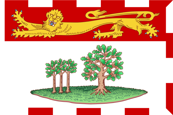
In 2022, Prince Edward Island was the 10th most populated province, with a population of 166 331[3]. This province covers 5 620 km2 of the country[7].
The province is part of the Appalachian physiographic region.
The Island's landscape is notable for its reddish soil in many places, due to high concentrations of iron oxide.
Source : Yuriy Boyko_Ukraine, Shutterstock.com
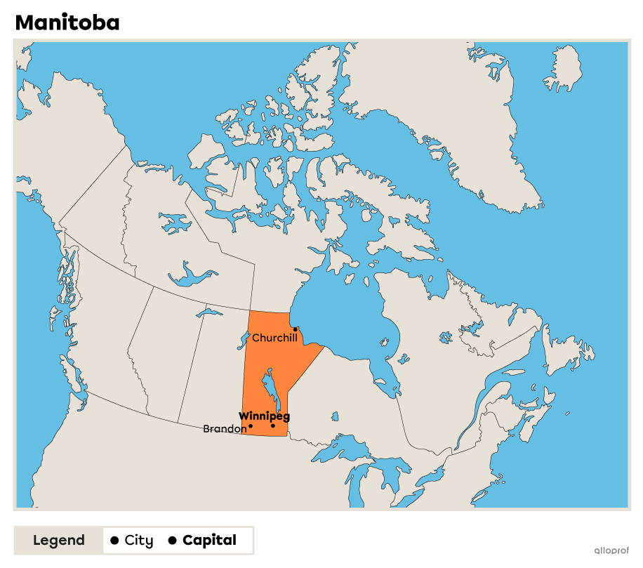
In 2022, Manitoba was the 5th most populated province, with a population of 1 390 249[3]. This province covers 650 000 km2 of the country[8].
The province is divided between 3 physiographic regions: the Hudson Bay Lowlands, the Canadian Shield and the Inland Plains.
Manitoba's landscape is marked by the prairies, where agriculture is practised, and by its many freshwater rivers.
Fun fact: the town of Churchill in Manitoba is known as the best place in the world to see the Northern Lights.
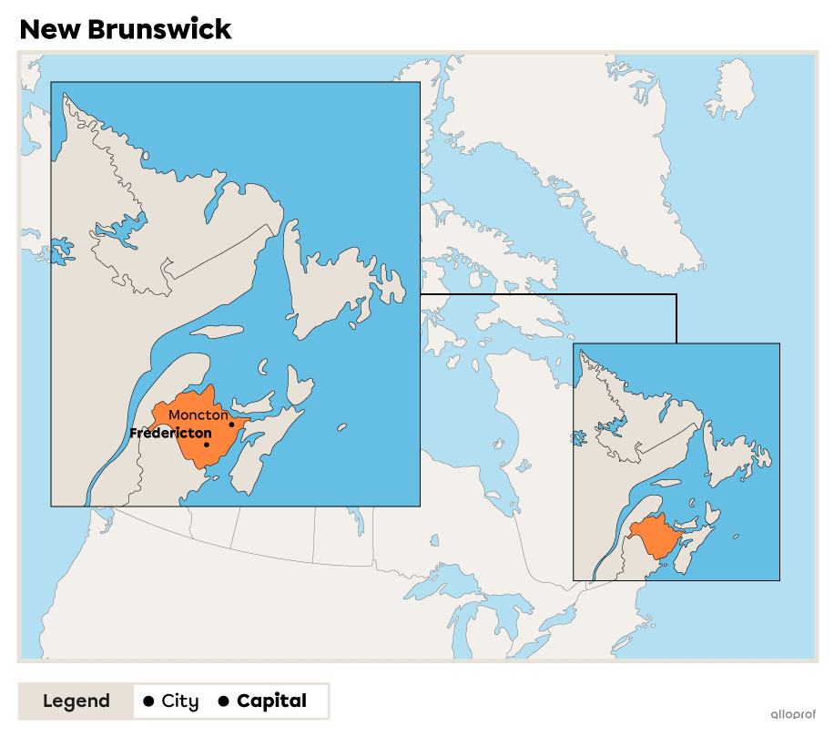
In 2022, New Brunswick was the 8th most populated province, with a population of 797 102[3]. This province covers 73 440 km2 of the country[9].
The province is part of the Appalachian physiographic region.
New Brunswick's landscape varies from more rugged in the north to flatter in the south.
The province’s landscape is shaped by the Bay of Fundy, known for having the highest tides in the world[10].
A tide is the daily rise and fall in water level caused by the effects of the gravitational pull of the Moon and the Sun.
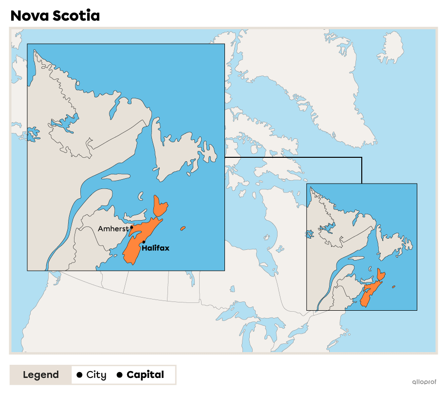
In 2022, Nova Scotia was the 7th most populated province, with a population of 1 002 586[3]. This province covers 52 942 km2 of the country[11].
The province is part of the Appalachian physiographic region.
Nova Scotia's landscape is marked by its proximity to the ocean.
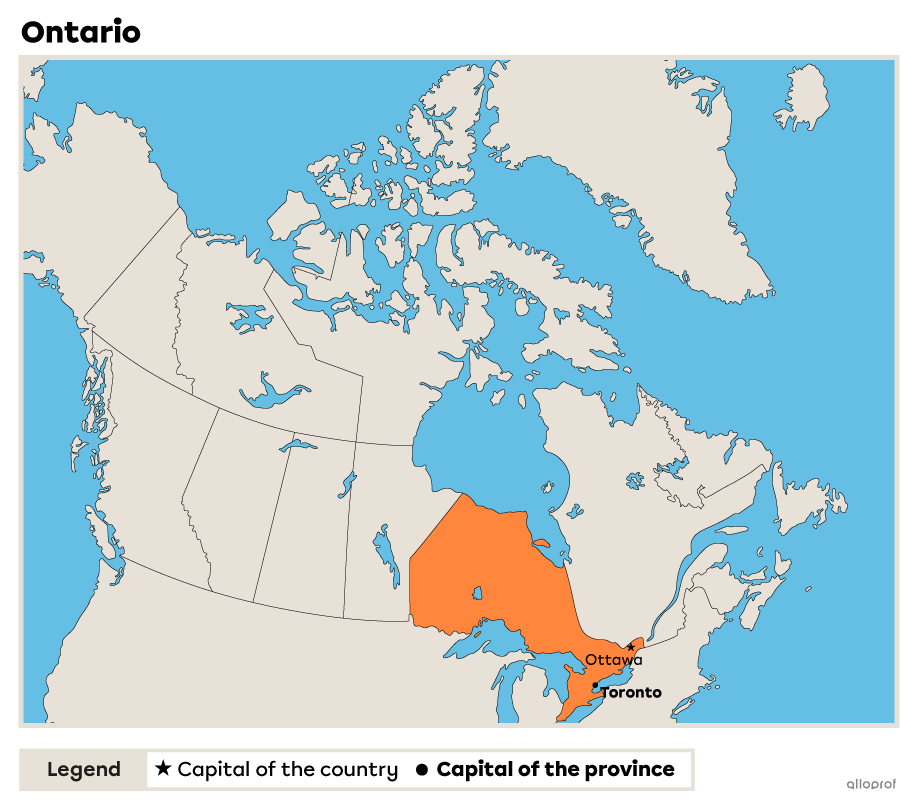
In 2022, Ontario had a population of 14 951 825[3], making it the country's most populated province. This province covers 802 775 km2 of the country[13].
Ontario is divided between 3 physiographic regions: the Hudson's Bay Lowlands, the Canadian Shield and the St. Lawrence Lowlands.
Ontario's landscape is marked by the Great Lakes region in the south of the province.
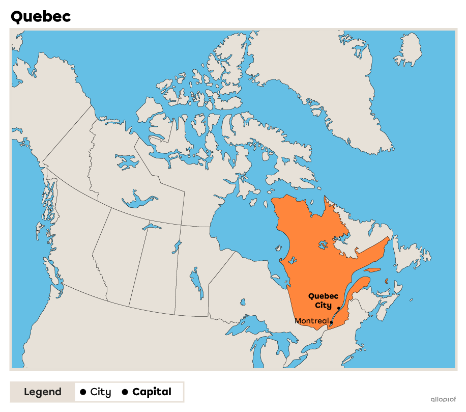
In 2022, Quebec was the 2nd most populous province, with a population of 8 639 642[3]. This province covers 1 700 000 km2 of the country[14].
Quebec is divided between 3 physiographic regions: the St. Lawrence Lowlands, the Canadian Shield and the Appalachian.
The landscape of Quebec is marked by the St. Lawrence Valley to the south and the Arctic tundra biome to the north.
Quebec has 17 administrative regions and 22 tourist regions.
A biome refers to a community of plants and animals in an environment.

In 2022, Saskatchewan was the 6th most populated province, with a population of 1 183 269[3]. This province covers 651 036 km2 of the country[15].
The province is separated by 2 physiographic regions: the Inland Plains and the Canadian Shield.
Saskatchewan's landscape is characterized by vast stretches of farmland.
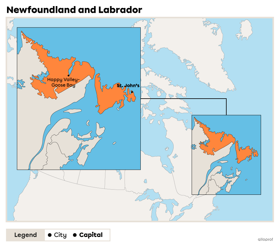
In 2022, Newfoundland and Labrador was the 9th most populated province, with a population of 522 453[3]. This province covers 405 720 km2 of the country[16].
The Canadian Shield, the Appalachian Mountains and the St. Lawrence Lowlands are the 3 physiographic regions that run through the province.
It is the country's most easterly province. Its landscape is marked by its proximity to the ocean.
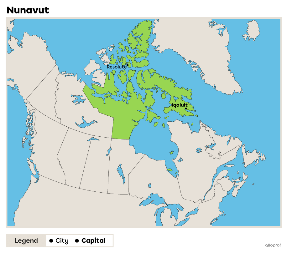
In 2022, Nunavut was the least populated of the 3 territories, with a population of 39 710[3]. This territory covers 1 936 113 km2 of the country[12].
The territory is crossed by 3 physiographic regions: the Hudson Bay Lowlands, the Canadian Shield and the Arctic Lands.
The landscape of Nunavut is marked by the many islands, bays and rivers that reach as far as the Arctic.
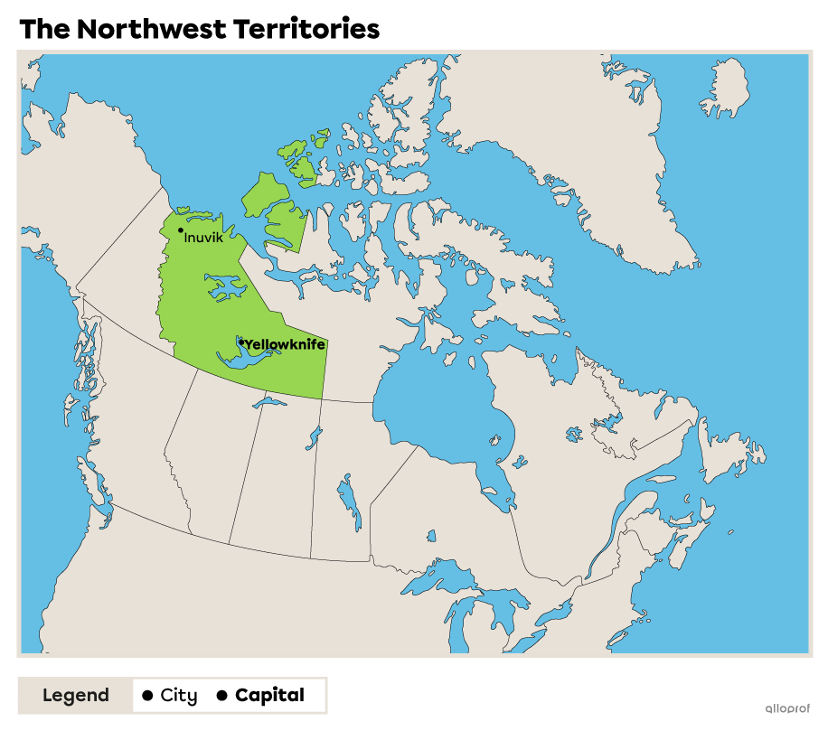
In 2022, the Northwest Territories was the most populated territory, with a population of 45 640[3]. This territory covers 1 143 793 km2 of the country[17].
The Northwest Territories are crossed by 3 physiographic regions: the Cordillera, the interior Plains, the Canadian Shield and the Arctic lands.
The landscape of the Northwest Territories is characterized by the Arctic tundra biome.
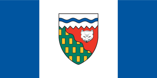
Source : N. Vector Design, Shutterstock.com
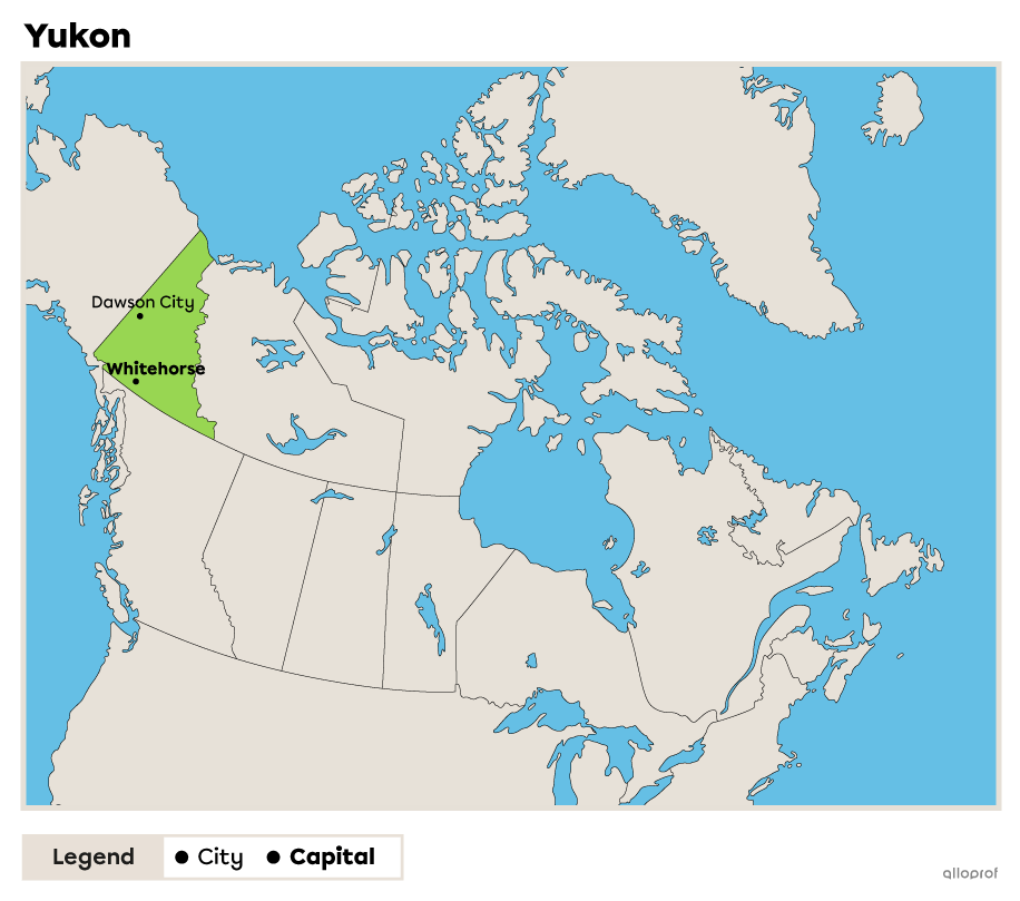
In 2022, Yukon was the 2nd most populated territory, with a population of 42 982[3]. This territory covers 474 712 km2 of the country[18].
The Yukon is divided between 3 physiographic regions: the Cordillera, the Arctic Lands and the Inland Plains.
The Yukon landscape is marked by large mountains in the south-west, including Mount Logan, which is the highest peak in Canada.
For more information, please consult the following concept sheets.
To access the rest of the unit, consult the Tools in Geography concept sheet.
1. Statistics Canada. (2018, January 17). Geography. Government of Canada. https://www150.statcan.gc.ca/n1/pub/11-402-x/2011000/chap/geo/geo-eng.htm
2. ÉduCanada. (July 26th). Au sujet du Canada. Gouvernement du Canada. https://www.educanada.ca/study-plan-etudes/before-avant/about-canada-a-propos.aspx?lang=fra
3. Statistics Canada. (2022, March 17). Population estimates, quarterly. Government of Canada. https://www150.statcan.gc.ca/t1/tbl1/en/tv.action?pid=1710000901&request_locale=
4. Encyclopédie universalis. (n.d.). Alberta province d’. https://www.universalis.fr/encyclopedie/province-d-alberta/
5. La Société de développement économique de la Colombie-Britannique (SDECB). (n.d.). Géographie. https://tourisme-cb.com/infos-province/geographie/
6. Robinson, J. L. (2020, July 24). Geography of British Columbia. The Canadian Encyclopedia. https://www.thecanadianencyclopedia.ca/en/article/geography-of-british-columbia
7. Prince Edward Island Government. (2015, May 10). Island Geography. https://www.princeedwardisland.ca/en/information/executive-council-office/island-geography
8. Government of Manitoba. (n.d.). The Land. https://www.gov.mb.ca/jec/mbadvantage/theland.html
9. Government of New Brunswick. (n.d.). Geography. https://www2.gnb.ca/content/gnb/en/gateways/about_nb/geography.html
10. Parks Canada. (2020, March 11). Tides in Fundy National Park. Government of Canada. https://parks.canada.ca/pn-np/nb/fundy/nature/environment/marees-tides
11. Statistics Canada. (2021, October 27). Census Profile, 2016 Census. Government of Canada. https://www12.statcan.gc.ca/census-recensement/2016/dp-pd/prof/details/page.cfm?Lang=E&Geo1=POPC&Code1=0348&Geo2=PR&Code2=12&
12. Kikkert, P. (2021, december 2). Nunavut. The Canadian Encyclopedia. https://www.thecanadianencyclopedia.ca/en/article/nunavut
13. Ministère du Développement, du Nord et des Mines. (2012, november). Profil du Nord de l’Ontario. Gouvernement de l’Ontario. https://www.mndm.gov.on.ca/sites/default/files/northern_ontario_profile-fr_0.pdf
14. Gouvernement du Québec. (2022, June 2). Géographie du territoire québécois. https://www.quebec.ca/gouvernement/portrait-quebec/geographie-territoire
15. Saskatchewan’s Bureau of Statistics. (2021). Saskatchewan Factsheet 2021. Ministry of Finances.
16. Patrimoine de Terre-Neuve-et-Labrador. (2013, August). Situation géographique et environs. https://www.heritage.nf.ca/articles/en-francais/environment/situation-geographique-environs.php
17. Statistics Canada. (2021, October 27). Census Profile, 2016 Census. Government of Canada. https://www12.statcan.gc.ca/census-recensement/2016/dp-pd/prof/details/Page.cfm?Lang=E&Geo1=PR&Code1=61&Geo2=&Code2=&Data=Count&
18. Statistics Canada. (2019, March 26). Focus on Geography Series, 2011 Census. Government of Canada. https://www12.statcan.gc.ca/census-recensement/2011/as-sa/fogs-spg/Facts-pr-eng.cfm?LANG=Eng&GK=PR&GC=60


