To access the other concept sheets in the Cities Subject to Natural Hazards unit, check out the See Also section.
Due to natural hazards being present, cities that are subject to these hazards have to focus on prevention. Since it’s impossible to prevent a natural disaster, cities must be prepared in order to limit the potential material damage and loss of human life resulting from such disasters.
-
In geography, an issue is a problem related to the use or the planning and development of a territory. An issue can be environmental, economic, political, social, etc.
-
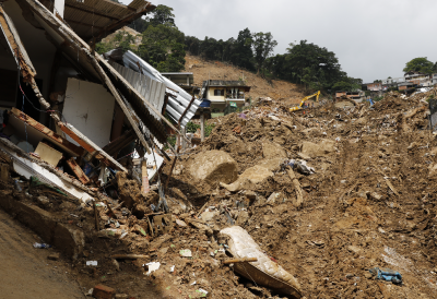
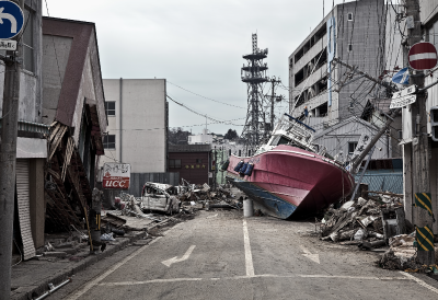
A natural disaster is a natural phenomenon that causes material damage (to buildings, roads, etc.) and human victims (injuries, loss of life, etc.).
-
A natural hazard is a danger related to a natural phenomenon.
-
Prevention refers to all of the measures taken to reduce or avoid the impacts of a natural disaster.
The problem is that certain cities are poorly prepared and protected against natural disasters. These cities generally experience more damage and loss of human life than those that are better prepared.
There are several reasons why certain cities are poorly prepared to protect themselves from natural disasters.
-
The existence of several types of natural hazards, each type requiring different planning and development.
-
Since building-resistant infrastructures are extremely expensive, the quality and solidity of existing infrastructures, such as buildings, roads, and bridges, are a factor.
-
The city’s population density is another factor. When a lot of people live on a limited territory, protecting them can be complicated.
-
Certain natural disasters can be impossible to predict, such as tornadoes.
-
Cities in developing countries do not always have the financial means or resources needed to be well prepared.
-
Developing countries have little industrial and economic activity and their inhabitants generally have low incomes leading to lower standards of living.
-
Infrastructure refers to a structure or set of structures (roads, bridges, buildings, sewers, etc.) that enable the planning and development of a territory.
-
Planning and development is the modification or transformation of a territory with the goal of making it accessible, functional and usable.
-
Population density refers to the average number of individuals living in a given area. It measures the number of inhabitants per square kilometre (inhabitants/km2).
Natural disasters can have similar consequences:
-
Material damage (damaged or destroyed infrastructure)
-
Victims (deaths, disappearances, injuries, displacement, homelessness)
-
Interruption of essential services (water, electricity, communications)
However, each type of natural disaster also has its own consequences.
| Natural disaster | Consequences |
|---|---|
|
|
|
|
|
|
|
|
|
Tornado |
|
|
Hurricane, cyclone, typhoon |
|
|
Flood |
|
|
Winter storm |
|
Source: Fly_and_Dive, Shutterstock.com
Prevention is the best choice of action in the face of natural hazards. Although it’s impossible to stop or avoid a natural disaster, prevention helps reduce the consequences.
Various stakeholders can be involved in the search for solutions.
| Stakeholders | Role |
|---|---|
| Governments and city officials | Their responsibilities include putting in place preventive measures and organizing an action plan to implement during and after a natural disaster. |
| The population | The population should be aware and informed of the possible dangers as well as what preventive measures should be taken and the emergency procedures to follow during and after a natural disaster. |
| Scientists and research centres | Scientists can develop different technologies to help with prevention during a natural disaster. More importantly, research centres monitor the various natural hazards and warn officials and the population before natural disasters occur. |
| International organizations | After a natural disaster occurs, international organizations provide humanitarian aid such as food, water and medical care. They also help certain cities implement action plans in case of a natural disaster. |
Cities can put various measures in place to ensure that they are well prepared in the event of a natural disaster:
-
Informing the population of the risks and measures to take before, during and after a natural disaster
-
Establishing an emergency plan and informing the population about it
-
Establishing a monitoring system to predict natural disasters
-
Establishing a warning system in case of a natural disaster makes it possible to evacuate the population at risk
-
Putting in place building standards to ensure solid infrastructure
-
Forbidding people from settling in at-risk areas and building neighbourhoods far from these areas
These preventive measures are used for most natural hazards. However, there are other measures specific to one or two natural hazards.
Here are certain measures that can be put in place to limit the damage from volcanic eruptions.
-
Monitoring ground movements around volcanoes often makes it possible to predict a volcanic eruption and evacuate the population.
-
Reinforcing certain buildings so that they can resist the accumulation of ash.
-
Building anti-lava barriers close to volcanoes to redirect lava and mud flows and protect towns and fields around the volcano.
-
Preparing emergency plans and evacuation plans to protect the populations at risk in the event of an eruption.
Volcanoes are monitored from various observation centres around the world. Scientists monitor four different parameters.
-
Seismic activity is the most important parameter. Setting up seismic stations is the most effective way to detect a volcanic eruption.
-
Scientists monitor changes in the volcano’s geophysical parameters (magnetic, electric, etc.).
-
Scientists will also verify the surface of the volcano, since the presence of magma often creates a swelling.
-
The presence of magma can also lead to changes in a volcano’s gas composition.
Here are certain measures that can be put in place to limit the damage from earthquakes:
-
Setting up a system to detect and analyze seismic activity is useful, although such a system cannot predict the exact moment an earthquake will occur.
-
Prioritizing earthquake-resistant building standards is essential for limiting material damage.
-
Implementing preventive exercises is essential so that the population knows how to keep safe during an earthquake.
An earthquake-resistant building is a building that is able to resist earthquakes.
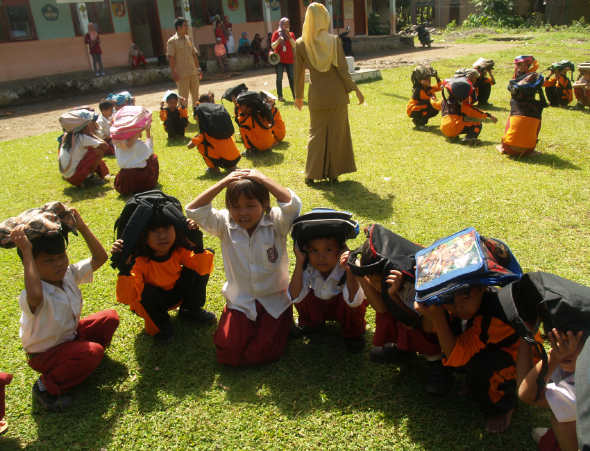
Students in Sungai Limau, Indonesia, Performing an Earthquake Preparation Exercise.
Source: Frans Delian, Shutterstock.com
Here are a few measures that can be put in place to limit the damage from tsunamis:
-
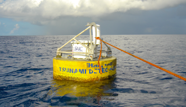
Establishing a system for detecting underwater earthquakes in order to assess the risk of a tsunami
-
Implementing a tsunami warning system to alert coastal populations and evacuate at-risk zones
The National Oceanic and Atmospheric Administration (NOAA) in the United States and the American National Weather Service (NWS) have established a tsunami monitoring program. The NWS runs two tsunami warning centres that monitor all of the Pacific Ocean and the eastern Atlantic Ocean. These centres run 7 days a week, 24 hours a day.
The centres have an earthquake detection and sea observation system. These systems and predictive models make it possible to determine the location of the tsunami and the precise moment to issue a tsunami warning.
This tsunami monitoring program is extremely important in the global tsunami warning system. The program allows all countries with coastlines in the monitored areas to be warned in the event of a tsunami.
The NOAA and NWA’s tsunami programs also play a vital role in the global warning system.
Here are a few measures that can be put in place to limit the damage from landslides:
-
Identify at-risk slopes and avoid building homes and infrastructure there
-
Be aware of events that could lead to landslides (earthquake, tsunami, flood, etc.)
-
Monitor populated zones that are at risk and evaluate the need to preventively evacuate the people living there
-
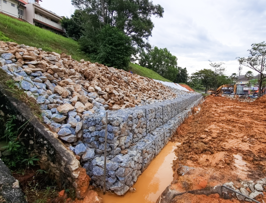
Prevent landslides by implementing certain civil engineering measures (improving drainage, reducing the incline of a slope, etc.)
Here are a few measures that can be put in place to limit the damage from tornadoes:
-
Monitor weather conditions to predict when the risk of tornadoes is very high. However, a tornado’s trajectory is impossible to determine in advance.
-
Issue a tornado warning to alert the population to move to a safe location
-
Know of safe places to go in the event of a tornado (basement, far from windows and exterior walls, etc.)
In Canada, there are two possible types of alerts for tornadoes: a tornado watch or a tornado warning. The government issues a tornado watch when there are conditions that could lead to violent storms and tornadoes. A tornado warning is issued when a tornado has been reported or is imminent.
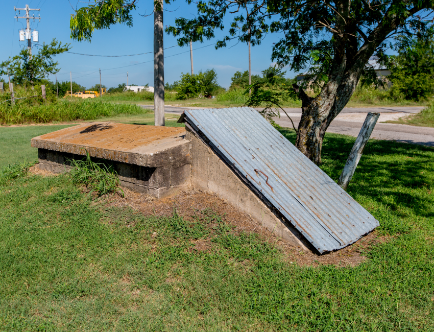
In regions where tornadoes are common, some residents build tornado shelters, often underground, away from the winds.
Source: Richard A McMillin, Shutterstock.com
Here are certain measures that can be put in place to limit the damage from hurricanes, cyclones and typhoons:
-
Track the progression of hurricanes, typhoons and cyclones is essential. Meteorologists can almost always predict their trajectory.
-
Inform the population of the time the cyclone will hit their region and evacuate them if necessary
-
Build seawalls along the coastline to restrain the waves and minimize flooding and damage
-
Reforest the coastline to create a natural barrier against strong winds
-
Prioritize construction on stilts to protect the buildings from floods
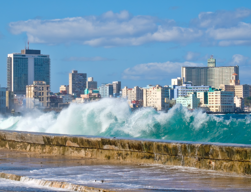
This seawall protects the city of Havana from powerful waves.
Source: Kamira, Shutterstock.com
Here are certain measures that can be put in place to limit the damage from floods:
-
Monitor waterways and the weather in order to predict floods a few days before they hit, and evacuate the population if necessary
-
Avoid building in flood zones
-
Prioritize building on stilts to protect the buildings
-
Avoid building dams and canals around waterways that can overflow and cause flooding
-
Improve the rainwater collection system
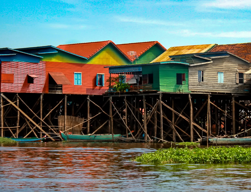
Building on stilts protects houses from the frequent flooding in the flood plains in Cambodia.
Source: Kylie Nicholson, Shutterstock.com
Here are certain measures that can be put in place to limit the damage from winter storms:
-
Monitor weather predictions in order to warn the population of a possible winter storm
-
Put in place a strategy to remove snow from roads as fast as possible
-
Close certain locations (schools, stores, etc.) in order to reduce road use
-
Close sections of roads that become too dangerous
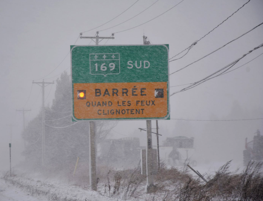
Roads may be closed during a winter storm if driving conditions become too dangerous.
Source: Route 169 fermée [Photography], TC MEDIA, 2016, Le Lac-St-Jean, (URL). Rights reserved*[1]
Certain cities are more vulnerable to natural hazards than others. The level of development of the country where the city is located affects its ability to protect itself in the event of a natural disaster.
Developed countries have financial, material and technological resources that enable them to be prepared before, during and after a natural disaster. Developing countries often have fewer resources and larger populations to protect, which makes these populations very vulnerable to natural disasters. A person in a developing country has seven times more chance of dying during a natural disaster than a person in a developed country[2].
| Developed countries | Developing countries |
|---|---|
|
|
A slum is a living area close to a metropolis where very disadvantaged people live. Slums have few or no basic services (water, sewers, electricity, etc.).
Different solutions exist to come to the aid of developing countries before and after a natural disaster.
-
The organizations in developed countries that monitor natural hazards inform the officials of developing countries when they detect risks of a natural disaster.
-
Several international organizations provide assistance to developing countries after a natural disaster, such as the Red Cross, which helps displaced people (food, water, shelter, clothing, etc.) and Doctors Without Borders, which provides medical care.
-
The governments of foreign countries can also provide help in the form of financial resources.
To access the rest of the unit, you can consult the following concept sheets.
1. TC MEDIA. (2016, 1er décembre). Route 169 fermée [Photographie]. Le Lac-St-Jean. (URL). *Extrait employé par Alloprof conformément à la Loi sur le droit d’auteur dans le cadre d’une utilisation équitable aux fins d’éducation [https://laws-lois.justice.gc.ca/fra/lois/c-42/page-9.html].
2. Fontaine, V., Ouimet, K., Paiement-Paradis, G., Parent, A. et Lavoie, R. (2020). Complètement GÉO! Les villes soumises à des risques naturels - 2e secondaire [cahier d’apprentissage]. Chenelière Éducation.

